Riverton, Indiana | |
|---|---|
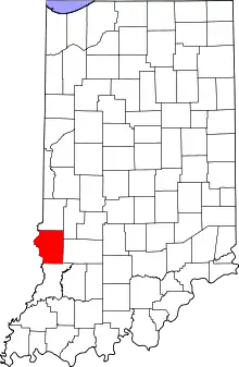 Sullivan County's location in Indiana | |
 Riverton Sullivan County, Indiana | |
| Coordinates: 39°01′13″N 87°34′04″W / 39.02028°N 87.56778°W | |
| Country | United States |
| State | Indiana |
| County | Sullivan |
| Township | Gill |
| Elevation | 436 ft (133 m) |
| Time zone | UTC-5 (Eastern (EST)) |
| • Summer (DST) | UTC-4 (EDT) |
| ZIP code | 47861 |
| Area code(s) | 812, 930 |
| FIPS code | 18-64872[2] |
| GNIS feature ID | 442104 |
Riverton is an unincorporated community in Gill Township, Sullivan County, in the U.S. state of Indiana.[3]
The community is part of the Terre Haute Metropolitan Statistical Area.
History
Riverton was laid out in 1887, and was named after its location on the Wabash River.[4] A post office was established at Riverton in 1887, and remained in operation until it was discontinued in 1905.[5]
Geography
Riverton is located at 39°01′13″N 87°34′04″W / 39.02028°N 87.56778°W.
References
- ↑ "US Board on Geographic Names". United States Geological Survey. October 25, 2007. Retrieved January 31, 2008.
- ↑ "U.S. Census website". United States Census Bureau. Retrieved January 31, 2008.
- ↑ "Riverton, Indiana". Geographic Names Information System. United States Geological Survey. Retrieved August 5, 2017.
- ↑ Baker, Ronald L. (October 1995). From Needmore to Prosperity: Hoosier Place Names in Folklore and History. Indiana University Press. p. 281. ISBN 978-0-253-32866-3.
...laid out in November 1887 and so named because of its location on the Wabash River.
- ↑ "Sullivan County". Jim Forte Postal History. Retrieved September 28, 2016.
Municipalities and communities of Sullivan County, Indiana, United States | ||
|---|---|---|
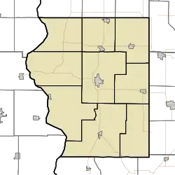
| Cities | Map of Indiana highlighting Sullivan County | |
| Towns | ||
| Townships | ||
| CDPs | ||
| Other communities | ||
| Ghost towns | ||
| Footnotes | ‡This populated place also has portions in an adjacent county or counties | |
This article is issued from Wikipedia. The text is licensed under Creative Commons - Attribution - Sharealike. Additional terms may apply for the media files.