Following international norms, road signs in Nepal are controlled by the Nepali Department of Roads and are heavily influenced by those used in the United Kingdom. [1] [2]
Nepal drives on the left.
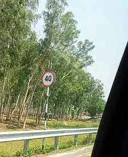
Speed Limit sign at E-W Hwy H01 Jhapa section
Regulatory signs
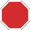 A1: Stop and give way
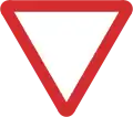 A2: Give way
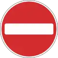 A3: No entry
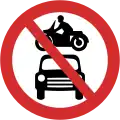 A4: No motor vehicles
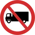 A5: No trucks
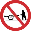 A6: No handcarts
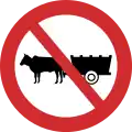 A7: No bullock carts
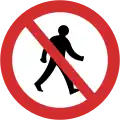 A8: No pedestrians
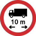 A9: No vehicles over length shown
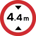 A10: No vehicles over height shown
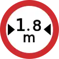 A11: No vehicles over width shown
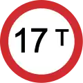 A12: No vehicles over maximum gross weight shown
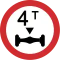 A13: Axle weight limit
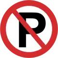 A14: No parking
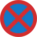 A15: No stopping
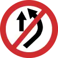 A16: No overtaking
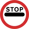 A17: No passing without stopping
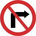 A18: No right turn
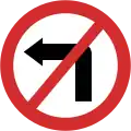 A19: No left turn
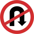 A20: No U turns
 A21: No use of horn
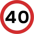 A22: Maximum speed
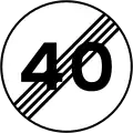 A23: End of speed restriction
 A24: Temporary stop sign
 A25: Temporary go sign
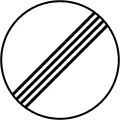 A26: Restriction ends
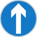 A27: Go straight ahead only
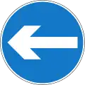 A28: Turn left
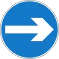 A28: Turn right
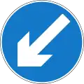 A29: Keep left
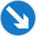 A29: Keep right
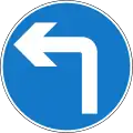 A30: Turn left ahead
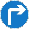 A30: Turn right ahead
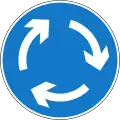 A31: Mini roundabout
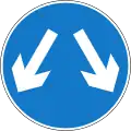 A32: Pass either side
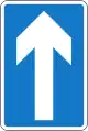 A33: One way traffic
Warning signs
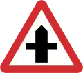 B1: Crossroads with a minor ahead
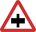 B2: Crossroad with a major road ahead
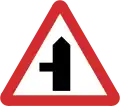 B3: Side road on the left ahead
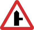 B3: Side road on the right ahead
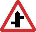 B4: Staggered junction ahead
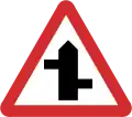 B4: Staggered junction ahead
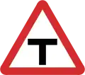 B5: T-junction ahead
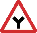 B6: Y-junction ahead
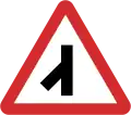 B7: Traffic merges from left
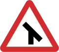 B8: Traffic merges from right
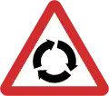 B9: Roundabout ahead
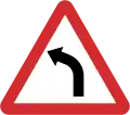 B10: Sharp bend to the left ahead
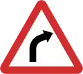 B10: Sharp bend to the right ahead
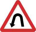 B11: Hairpin bend to the left ahead
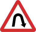 B11: Hairpin bend to the right ahead
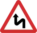 B12: Double bend ahead first to the left
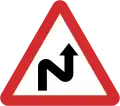 B12: Double bend ahead first to the right
 B13: Sharp bend to the left
 B13: Sharp bend to the right
 B13: Sharp bend to the left
 B13: Sharp bend to the right
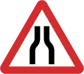 B14: Road narrows on both sides
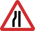 B15: Road narrows on left sides
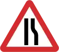 B15: Road narrows on right sides
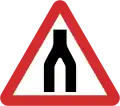 B16: Dual carriageway ends ahead
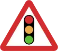 B17: Traffic signals ahead
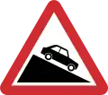 B18: Steep hill downwards
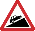 B19: Steep hill upwards
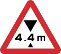 B20: Height limit ahead
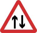 B21: Two-way traffic straight ahead
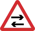 B22: Two-way traffic crosses one way road
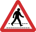 B23: Pedestrian crossing ahead
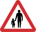 B24: Pedestrians in road ahead
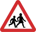 B25: Children ahead
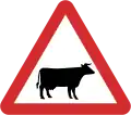 B26: Cattle ahead
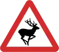 B27: Wild animals ahead
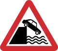 B28: Unprotected quayside or riverbank ahead
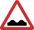 B29: Uneven road
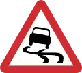 B30: Slippery road surface ahead
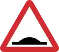 B31: Road hump
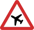 B32: Low-flying aircraft ahead
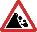 B33: Falling rocks
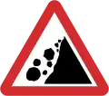 B33: Falling rocks
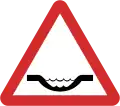 B34: Dangerous dip
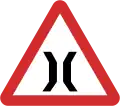 B35: Narrow bridge ahead
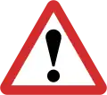 B36: Other danger ahead
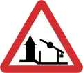 B37: Checkpoint ahead
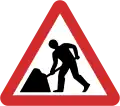 B38: Roadworks ahead
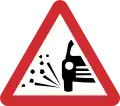 B39: Loose chippings
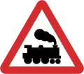 B40: Railway level crossing ahead without gate or barrier
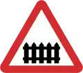 B41: Railway level crossing ahead with gate or barrier
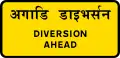 B42: Diversion ahead
 B43: Dangerous obstruction (Verges)
 B43: Dangerous obstruction (verges)
 B44: Dangerous obstruction (Central reservation)
 B45: T Junction
 B46: Sharp bend
 B46: Sharp bend
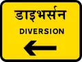 B47: Diversion
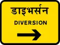 B47: Diversion
Information signs
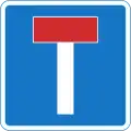 C1: No through road
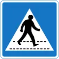 C2: Pedestrian crossing
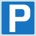 C3: Parking place
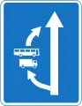 C4: Overtaking section
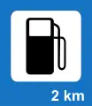 C5: Filling station
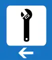 C6: Breakdown service
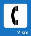 C7: Telephone
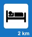 C8: Overnight accommodation
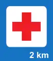 C9: First-aid post
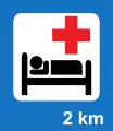 C10: Hospital
 C11: Refreshments
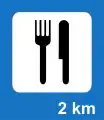 C12: Restaurant
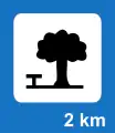 C13: Picnic Site
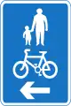 C14: Recommended route for pedestrians and cyclists
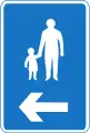 C15: Recommended route for pedestrians
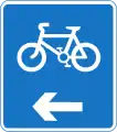 C16: Recommended route for cyclists
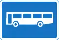 C17: Bus Stop
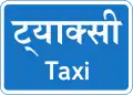 C18: Taxi Rank
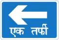 C19: One way traffic
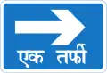 C19: One way traffic
 C20: Beginning of City Limit
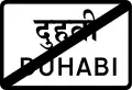 C21: End of City Limit
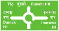 C22: Advance directional for roundabouts (main roads)
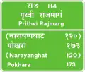 C23: Reassurance directional (main roads)
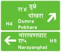 C24: Advance directional (main roads)
 C25: Intersection directional (main roads)
 C26: Intersection directional (temporary)
 C27: Intersection directional
 C28: Advance directional
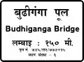 C29: Bridge name
Additional signs
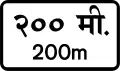 D1: Distance warning
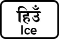 D12: Ice
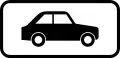 D17: Cars
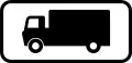 D18: Trucks
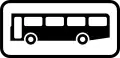 D19: Buses
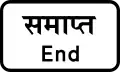 D25: End
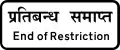 D26: End of Restriction
References
Road signs in Asia | |
|---|---|
| Sovereign states |
|
| States with limited recognition |
|
| Dependencies and other territories |
|
| |
This article is issued from Wikipedia. The text is licensed under Creative Commons - Attribution - Sharealike. Additional terms may apply for the media files.