| Robinson Run Tributary to Chartiers Creek | |
|---|---|
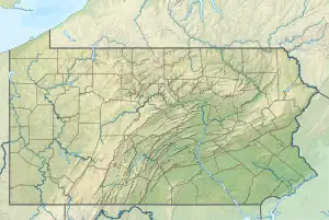 Location of Robinson Run mouth  Robinson Run (Chartiers Creek tributary) (the United States) | |
| Location | |
| Country | United States |
| State | Pennsylvania |
| County | Allegheny Washington |
| Borough | Midway McDonald Oakdale |
| Physical characteristics | |
| Source | Cherry Run divide |
| • location | about 0.5 miles east southeast of Candor, Pennsylvania |
| • coordinates | 40°23′14″N 080°17′57″W / 40.38722°N 80.29917°W[1] |
| • elevation | 1,200 ft (370 m)[2] |
| Mouth | Chartiers Creek |
• location | Glendale, Pennsylvania |
• coordinates | 40°25′52″N 080°05′59″W / 40.43111°N 80.09972°W[1] |
• elevation | 780 ft (240 m)[3] |
| Length | 15.90 mi (25.59 km)[4] |
| Basin size | 39.90 square miles (103.3 km2)[5] |
| Discharge | |
| • location | Chartiers Creek |
| • average | 40.15 cu ft/s (1.137 m3/s) at mouth with Chartiers Creek[5] |
| Basin features | |
| Progression | Chartiers Creek → Ohio River → Mississippi River → Gulf of Mexico[4] |
| River system | Ohio River |
| Tributaries | |
| • left | North Branch Robinson Run Pinkerton Run Scotts Run |
| • right | unnamed tributaries |
| Bridges | Midway-Candor Road, Railroad Street, Montgomery Street, Sycamory Street, Jefferson Street, St. John Street, Noblestown Road (x2), S McDonald Street, Laurel Hill Road, Station Street, Main Street, Scotch Hill Road, Union Avenue, Gregg Station Road, Nike Site Road, Walkers Mill Road, Dorrington Road, Noblestown Road, I-79, Noblestown Road |
Robinson Run is a 15.90 mi (25.59 km) long 2nd order tributary to Chartiers Creek in Allegheny and Washington Counties, Pennsylvania.
Variant names
According to the Geographic Names Information System, it has also been known historically as:[1]
- Robinson's Run
Course
Robinson Run rises about 0.5 miles southeast of Candor, Pennsylvania and then flows northeasterly to join Chartiers Creek at Glendale.[3]
Watershed
Robinson Run drains 39.90 square miles (103.3 km2) of area, receives about 38.6 in/year of precipitation, has a wetness index of 339.05, and is about 51% forested.[5]
See also
References
- 1 2 3 "GNIS Detail - Robinson Run". geonames.usgs.gov. US Geological Survey. Retrieved 13 May 2021.
- ↑ "Get Maps". USGS Topoview. US Geological Survey. Retrieved 13 May 2021.
- 1 2 "Get Maps". USGS Topoview. US Geological Survey. Retrieved 13 May 2021.
- 1 2 "ArcGIS Web Application". epa.maps.arcgis.com. US EPA. Retrieved 13 May 2021.
- 1 2 3 "Robinson Run Watershed Report". US EPA Geoviewer. US EPA. Retrieved 13 May 2021.
This article is issued from Wikipedia. The text is licensed under Creative Commons - Attribution - Sharealike. Additional terms may apply for the media files.