Romney, Indiana | |
|---|---|
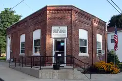 Post office at the corner of Main and High streets. | |
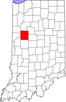 Tippecanoe County's location in Indiana | |
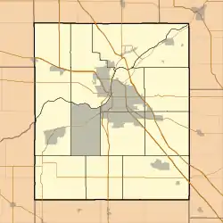 Romney Location in Tippecanoe County | |
| Coordinates: 40°15′05″N 086°54′10″W / 40.25139°N 86.90278°W | |
| Country | United States |
| State | Indiana |
| County | Tippecanoe |
| Township | Randolph |
| Area | |
| • Total | 0.88 sq mi (2.27 km2) |
| • Land | 0.88 sq mi (2.27 km2) |
| • Water | 0.00 sq mi (0.00 km2) |
| Elevation | 742 ft (226 m) |
| Population (2020) | |
| • Total | 304 |
| • Density | 347.43/sq mi (134.21/km2) |
| Time zone | UTC-5 (Eastern (EST)) |
| • Summer (DST) | UTC-4 (EDT) |
| ZIP code | 47981 |
| Area code | 765 |
| GNIS feature ID | 2813358[2] |
Romney is an unincorporated community in Randolph Township, Tippecanoe County, in the U.S. state of Indiana.[2]
The community is part of the Lafayette, Indiana Metropolitan Statistical Area.
History
Originally named Columbia,[3] Romney received its present name from the community of Romney, West Virginia.
The Romney post office has been in operation since 1842.[4]
Geography
Romney is located in Randolph Township, just south of the intersection of U.S. Route 231 and State Road 28.
Demographics
| Census | Pop. | Note | %± |
|---|---|---|---|
| 2020 | 304 | — | |
| U.S. Decennial Census[5] | |||
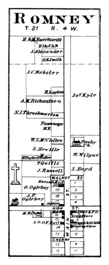
Romney in 1878.

Romney toy shop
References
- ↑ "2020 U.S. Gazetteer Files". United States Census Bureau. Retrieved March 16, 2022.
- 1 2 3 U.S. Geological Survey Geographic Names Information System: Romney, Indiana
- ↑ "USGS detail on Romney - Variant Citation". Retrieved July 25, 2016.
- ↑ "Tippecanoe County". Jim Forte Postal History. Retrieved July 25, 2016.
- ↑ "Census of Population and Housing". Census.gov. Retrieved June 4, 2016.
Municipalities and communities of Tippecanoe County, Indiana, United States | ||
|---|---|---|
| Cities | Map of Indiana highlighting Tippecanoe County | |
| Towns | ||
| Townships | ||
| CDPs | ||
| Other communities | ||
| Ghost towns | ||
| Footnotes | ‡This populated place also has portions in an adjacent county or counties | |
This article is issued from Wikipedia. The text is licensed under Creative Commons - Attribution - Sharealike. Additional terms may apply for the media files.