Roullours | |
|---|---|
Part of Vire Normandie | |
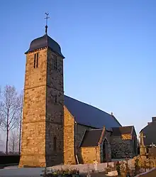 Saint Martin | |
Location of Roullours | |
 Roullours  Roullours | |
| Coordinates: 48°50′00″N 0°50′19″W / 48.8333°N 0.8386°W | |
| Country | France |
| Region | Normandy |
| Department | Calvados |
| Arrondissement | Vire |
| Canton | Vire Normandie |
| Commune | Vire Normandie |
| Area 1 | 13.15 km2 (5.08 sq mi) |
| Population (2019)[1] | 822 |
| • Density | 63/km2 (160/sq mi) |
| Time zone | UTC+01:00 (CET) |
| • Summer (DST) | UTC+02:00 (CEST) |
| Postal code | 14500 |
| Elevation | 169–308 m (554–1,010 ft) (avg. 312 m or 1,024 ft) |
| 1 French Land Register data, which excludes lakes, ponds, glaciers > 1 km2 (0.386 sq mi or 247 acres) and river estuaries. | |
Roullours (French pronunciation: [ʁuluʁ] ⓘ) is a former commune in the Calvados department in the Normandy region in northwestern France. On 1 January 2016, it was merged into the new commune of Vire Normandie.[2]
Population
| Year | Pop. | ±% |
|---|---|---|
| 1962 | 545 | — |
| 1968 | 502 | −7.9% |
| 1975 | 520 | +3.6% |
| 1982 | 555 | +6.7% |
| 1990 | 674 | +21.4% |
| 1999 | 769 | +14.1% |
| 2008 | 859 | +11.7% |
See also
References
- ↑ Téléchargement du fichier d'ensemble des populations légales en 2019, INSEE
- ↑ Arrêté préfectoral 31 December 2015 (in French)
Wikimedia Commons has media related to Roullours.
This article is issued from Wikipedia. The text is licensed under Creative Commons - Attribution - Sharealike. Additional terms may apply for the media files.