Ružiná | |
|---|---|
Village | |
 | |
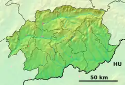 Ružiná Location of Ružiná in the Banská Bystrica Region 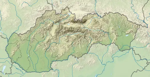 Ružiná Location of Ružiná in Slovakia | |
| Coordinates: 48°26′00″N 19°33′00″E / 48.43333°N 19.55000°E | |
| Country | |
| Region | Banská Bystrica |
| District | Lučenec |
| First mentioned | 1499 |
| Government | |
| • Mayor | Jozef Líška |
| Area | |
| • Total | 10.81 km2 (4.17 sq mi) |
| Elevation | 265 m (869 ft) |
| Population (31 December 2012) | |
| • Total | 874 |
| • Density | 81/km2 (210/sq mi) |
| Time zone | UTC+1 (CET) |
| • Summer (DST) | UTC+2 (CEST) |
| Postal code | 985 52 (pošta Divín) |
| Area code | 421-47 |
| Website | ruzina.eu |
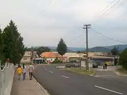
Ružiná (Hungarian: Rózsaszállás) is a village and municipality in the Lučenec District in the Banská Bystrica Region of Slovakia.[1] The town's attractions include the Ružiná dam[2] and the Divín Castle.[3] The town is home to the Church of St. František Assiský-the oldest building in the town, dating back to the mid-18th century.[4]
References
- ↑ "Obec Ružiná - Oficiálna stránka obce Ružiná". www.ruzina.eu. Retrieved 2021-10-29.
- ↑ "Ružiná dam - Slovakia.travel". slovakia.travel. Retrieved 2021-10-29.
- ↑ "The Divín Castle - Slovakia.travel". slovakia.travel. Retrieved 2021-10-29.
- ↑ "Kostol Ružiná". kostol--ruzina5-webnode-sk.translate.goog. Retrieved 2021-10-29.
External links
 Media related to Ružiná at Wikimedia Commons
- Official website

- http://www.statistics.sk/mosmis/eng/run.html
This article is issued from Wikipedia. The text is licensed under Creative Commons - Attribution - Sharealike. Additional terms may apply for the media files.