Ruffano
| |
|---|---|
| Comune di Ruffano | |
 | |
 Coat of arms | |
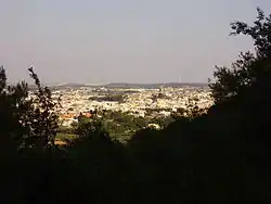
Location of Ruffano | |
 Ruffano Location of Ruffano in Italy 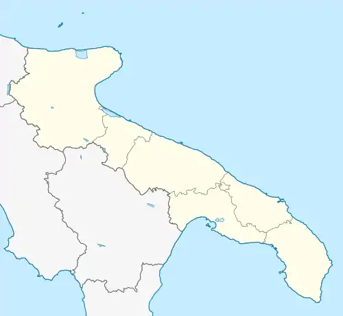 Ruffano Ruffano (Apulia) | |
| Coordinates: 39°59′N 18°15′E / 39.983°N 18.250°E | |
| Country | Italy |
| Region | |
| Province | Lecce (LE) |
| Frazioni | Torrepaduli |
| Government | |
| • Mayor | Antonio Rocco Cavallo |
| Area | |
| • Total | 39 km2 (15 sq mi) |
| Elevation | 127 m (417 ft) |
| Population (31 December 2010)[2] | |
| • Total | 9,724 |
| • Density | 250/km2 (650/sq mi) |
| Demonym | Ruffanesi |
| Time zone | UTC+1 (CET) |
| • Summer (DST) | UTC+2 (CEST) |
| Postal code | 73049 |
| Dialing code | 0833 |
| Patron saint | St. Antony of Padua |
| Website | Official website |
Ruffano (Salentino: Rufanu) is a town and comune in the province of Lecce, located in the Apulia region of southeast Italy.
Main sights
- Mother church of Natività della Beata Maria Vergine (1706–1713)
- Church of Madonna del Carmine, built in the 16th century above a Byzantine cave church from the 12th century
- Castello Brancaccio, a castle overlooking the town (1626)
- Crucifix Crypt, near the boundary with Casarano
- Grotta della Trinità ("Trinity Grotto"), used since Neolithic times. Starting from the 9th century, it housed a community of hermit monks and in the 11th century, it was turned into a religious place, as testified by remains of Byzantine frescoes.
References
- ↑ "Superficie di Comuni Province e Regioni italiane al 9 ottobre 2011". Italian National Institute of Statistics. Retrieved 16 March 2019.
- ↑ Population from Istat
This article is issued from Wikipedia. The text is licensed under Creative Commons - Attribution - Sharealike. Additional terms may apply for the media files.