Ruhmannsfelden | |
|---|---|
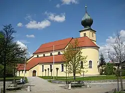 Saint Lawrence Church | |
 Coat of arms | |
Location of Ruhmannsfelden within Regen district 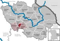 | |
 Ruhmannsfelden 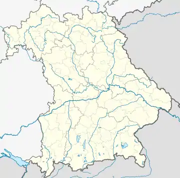 Ruhmannsfelden | |
| Coordinates: 48°59′N 12°59′E / 48.983°N 12.983°E | |
| Country | Germany |
| State | Bavaria |
| Admin. region | Niederbayern |
| District | Regen |
| Municipal assoc. | Ruhmannsfelden |
| Government | |
| • Mayor (2020–26) | Werner Troiber[1] (CSU) |
| Area | |
| • Total | 5.80 km2 (2.24 sq mi) |
| Elevation | 536 m (1,759 ft) |
| Population (2022-12-31)[2] | |
| • Total | 2,014 |
| • Density | 350/km2 (900/sq mi) |
| Time zone | UTC+01:00 (CET) |
| • Summer (DST) | UTC+02:00 (CEST) |
| Postal codes | 94239 |
| Dialling codes | 09929 |
| Vehicle registration | REG |
| Website | www.ruhmannsfelden.de |
Ruhmannsfelden is a larger municipality in the district of Regen, in Bavaria, Germany.
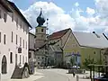 Town center
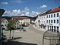 Town center
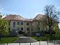 Town hall
References
- ↑ Liste der ersten Bürgermeister/Oberbürgermeister in kreisangehörigen Gemeinden, Bayerisches Landesamt für Statistik, 15 July 2021.
- ↑ Genesis Online-Datenbank des Bayerischen Landesamtes für Statistik Tabelle 12411-003r Fortschreibung des Bevölkerungsstandes: Gemeinden, Stichtag (Einwohnerzahlen auf Grundlage des Zensus 2011)
Wikimedia Commons has media related to Ruhmannsfelden.
Towns and municipalities in Regen (district) | ||
|---|---|---|
Coat of arms | ||
This article is issued from Wikipedia. The text is licensed under Creative Commons - Attribution - Sharealike. Additional terms may apply for the media files.