Sơn Hòa district
Huyện Sơn Hòa | |
|---|---|
District | |
| Country | |
| Region | South Central Coast |
| Province | Phú Yên |
| Capital | Củng Sơn |
| Area | |
| • Total | 370 sq mi (950 km2) |
| Population (2003) | |
| • Total | 57,835 |
| Time zone | UTC+7 (Indochina Time) |
Sơn Hòa is a rural district (huyện) of Phú Yên province in the South Central Coastal region of Vietnam. As of 2003 the district had a population of 50,212.[1] The district covers an area of 950 km2. The district capital lies at Củng Sơn.[1]
Climate
| Climate data for Sơn Hòa | |||||||||||||
|---|---|---|---|---|---|---|---|---|---|---|---|---|---|
| Month | Jan | Feb | Mar | Apr | May | Jun | Jul | Aug | Sep | Oct | Nov | Dec | Year |
| Mean daily maximum °C (°F) | 27.2 (81.0) |
29.4 (84.9) |
32.3 (90.1) |
35.0 (95.0) |
35.7 (96.3) |
34.6 (94.3) |
34.5 (94.1) |
34.1 (93.4) |
32.7 (90.9) |
30.2 (86.4) |
28.3 (82.9) |
26.7 (80.1) |
31.7 (89.1) |
| Daily mean °C (°F) | 22.2 (72.0) |
23.4 (74.1) |
25.4 (77.7) |
27.8 (82.0) |
28.8 (83.8) |
28.7 (83.7) |
28.4 (83.1) |
28.2 (82.8) |
27.1 (80.8) |
25.6 (78.1) |
24.2 (75.6) |
22.6 (72.7) |
26.0 (78.8) |
| Mean daily minimum °C (°F) | 19.0 (66.2) |
19.6 (67.3) |
21.2 (70.2) |
23.2 (73.8) |
24.6 (76.3) |
24.9 (76.8) |
24.6 (76.3) |
24.6 (76.3) |
23.9 (75.0) |
22.9 (73.2) |
21.8 (71.2) |
20.0 (68.0) |
22.5 (72.5) |
| Average precipitation mm (inches) | 27.7 (1.09) |
10.1 (0.40) |
33.5 (1.32) |
40.0 (1.57) |
147.7 (5.81) |
109.0 (4.29) |
92.3 (3.63) |
109.7 (4.32) |
208.1 (8.19) |
426.5 (16.79) |
393.1 (15.48) |
123.5 (4.86) |
1,734.6 (68.29) |
| Average rainy days | 11.2 | 4.8 | 4.6 | 5.9 | 13.5 | 12.6 | 12.6 | 14.2 | 18.5 | 20.5 | 20.6 | 17.1 | 156.6 |
| Average relative humidity (%) | 85.2 | 82.3 | 80.0 | 78.2 | 77.5 | 76.0 | 74.9 | 76.3 | 82.8 | 88.3 | 88.6 | 86.8 | 81.4 |
| Mean monthly sunshine hours | 145.0 | 181.8 | 249.6 | 250.9 | 255.6 | 220.7 | 239.4 | 219.4 | 184.5 | 152.4 | 113.1 | 97.5 | 2,304.5 |
| Source: Vietnam Institute for Building Science and Technology[2] | |||||||||||||
References
- 1 2 "Districts of Vietnam". Statoids. Retrieved March 20, 2009.
- ↑ "Vietnam Institute for Building Science and Technology" (PDF). Retrieved 16 August 2023.
13°10′01″N 108°55′01″E / 13.167°N 108.917°E
| Da Nang city | 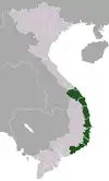 | |
|---|---|---|
| Bình Định province | ||
| Bình Thuận province | ||
| Khánh Hòa province |
| |
| Ninh Thuận province | ||
| Phú Yên province | ||
| Quảng Nam province | ||
| Quảng Ngãi province | ||
※ denotes provincial seat. / § Sovereignty over the Hoàng Sa and Trường Sa archipelagoes is disputed as of 27 December 2023. | ||
This article is issued from Wikipedia. The text is licensed under Creative Commons - Attribution - Sharealike. Additional terms may apply for the media files.