Saint-Bois | |
|---|---|
Part of Arboys en Bugey | |
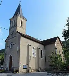 Église St Baudille | |
Location of Saint-Bois | |
 Saint-Bois  Saint-Bois | |
| Coordinates: 45°42′00″N 5°38′00″E / 45.7°N 5.6333°E | |
| Country | France |
| Region | Auvergne-Rhône-Alpes |
| Department | Ain |
| Arrondissement | Belley |
| Canton | Belley |
| Commune | Arboys en Bugey |
| Area 1 | 9.22 km2 (3.56 sq mi) |
| Population (2021)[1] | 142 |
| • Density | 15/km2 (40/sq mi) |
| Time zone | UTC+01:00 (CET) |
| • Summer (DST) | UTC+02:00 (CEST) |
| Postal code | 01300 |
| Elevation | 301–778 m (988–2,552 ft) (avg. 320 m or 1,050 ft) |
| 1 French Land Register data, which excludes lakes, ponds, glaciers > 1 km2 (0.386 sq mi or 247 acres) and river estuaries. | |
Saint-Bois (French pronunciation: [sɛ̃ bwa]) is a former commune in the Ain department in eastern France. On 1 January 2016, it was merged into the new commune Arboys en Bugey.[2]
Population
| Year | Pop. | ±% p.a. |
|---|---|---|
| 2006 | 116 | — |
| 2011 | 127 | +1.83% |
| 2021 | 142 | +1.12% |
| Source: INSEE[3][1] | ||
See also
References
- 1 2 "Populations légales 2021" [Legal populations 2021] (PDF) (in French). INSEE. December 2023.
- ↑ Arrêté préfectoral 29 September 2015 (in French)
- ↑ Populations légales 2011, INSEE
Wikimedia Commons has media related to Saint-Bois.
This article is issued from Wikipedia. The text is licensed under Creative Commons - Attribution - Sharealike. Additional terms may apply for the media files.