Saint-Louis | |
|---|---|
 | |
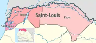 Location in the Saint-Louis Region | |
| Country | |
| Region | Saint-Louis Region |
| Capital | Saint-Louis |
| Area | |
| • Total | 879 km2 (339 sq mi) |
| Population (2013 census) | |
| • Total | 296,496 |
| • Density | 340/km2 (870/sq mi) |
| Time zone | UTC+0 (GMT) |
Saint-Louis Department is one of the 45 departments of Senegal, located in the Saint-Louis Region.
There are two communes in the department; Saint-Louis and Mpal
There is a single arrondissement, Rao, which comprises the rural districts (Communautés rurales) of:
- Fass Ngom
- Gandiole
- Gandon
In 2005, the population was estimated at 227,000.
Historic Sites[1]
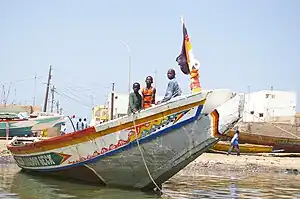
- Saint-Louis town
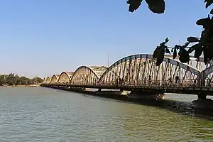
Faidherbe Bridge
- Island of Saint-Louis
- Faidherbe Bridge
- Ex-hydrobase and Stele at the statue of Jean Mermoz
- Fishermen's Cemetery, Langue de Barbarie
- Church and grotto of Notre-Dame de Lourdes, Sor Quarter, Saint-Louis
- Remains of the first brickworks of Africa - Bopp-ou-Thior Island (2 km from Saint-Louis)
- Keur Cluny : Old orphanage of the Soeurs de Saint-Joseph de Cluny, Ndar Toute, Saint-Louis
- Monument to Old Soldiers - Place Pointe à Pitre, Guet-Ndar
- Marmyale Catholic cemetery, Sor Quarter, Saint-Louis
- School of the Sons of the Chief and Spokesmen, Ecole Khayar Mbengue, Sor Quarter
- Railway Station
- Ancien Temple Protestant et Asile des esclaves, Pont de Khor Saint-Louis
- Arrondissement de Rao
- Tumuli of Rao (Nguiguéla, Mboy-u-Gar, Menguègne)
- Tower of Ndialakhar
- Ruins of the Fort of Laybar, near Saint-Louis
- The historic site of the Village of Nder
- Ruins of the Post Ofiice of the bar at Mouit
- The prehistoric site of the Marigot of Khant
References
16°01′56″N 16°37′00″W / 16.03222°N 16.61667°W
This article is issued from Wikipedia. The text is licensed under Creative Commons - Attribution - Sharealike. Additional terms may apply for the media files.