Salto de Pirapora | |
|---|---|
Municipality | |
 Flag  Coat of arms | |
 Location in São Paulo state | |
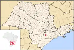
 Salto de Pirapora Location in Brazil | |
| Coordinates: 23°38′56″S 47°34′24″W / 23.64889°S 47.57333°W | |
| Country | |
| Region | Southeast Brazil |
| State | São Paulo |
| Metropolitan Region | Sorocaba |
| Area | |
| • Total | 280.70 km2 (108.38 sq mi) |
| Elevation | 630 m (2,070 ft) |
| Population (2020 [1]) | |
| • Total | 45,860 |
| • Density | 160/km2 (420/sq mi) |
| Time zone | UTC−3 (BRT) |
Salto de Pirapora (Portuguese pronunciation: [ˈsawtu dʒi piɾɐˈpɔɾɐ]) is a municipality in the state of São Paulo in Brazil. It is part of the Metropolitan Region of Sorocaba.[2] The population is 45,860 (2020 est.) in an area of 280.70 km2 (108.38 sq mi).[3] The elevation is 630 m (2,070 ft).
See also
References
- ↑ IBGE 2020
- ↑ "Governo do Estado de São Paulo, Lei Complementar nº 1.241, de 8 de maio de 2014". Archived from the original on 18 October 2014. Retrieved 2015-09-29.
{{cite web}}: CS1 maint: bot: original URL status unknown (link) - ↑ Instituto Brasileiro de Geografia e Estatística
This article is issued from Wikipedia. The text is licensed under Creative Commons - Attribution - Sharealike. Additional terms may apply for the media files.