Sankt Leonhard am Hornerwald | |
|---|---|
 Sankt Leonhard am Hornerwald | |
 Coat of arms | |
 Sankt Leonhard am Hornerwald Location within Austria | |
| Coordinates: 48°35′N 15°32′E / 48.583°N 15.533°E | |
| Country | Austria |
| State | Lower Austria |
| District | Krems-Land |
| Government | |
| • Mayor | Eva Schachinger, ÖVP |
| Area | |
| • Total | 51.6 km2 (19.9 sq mi) |
| Elevation | 582 m (1,909 ft) |
| Population (2018-01-01)[2] | |
| • Total | 1,119 |
| • Density | 22/km2 (56/sq mi) |
| Time zone | UTC+1 (CET) |
| • Summer (DST) | UTC+2 (CEST) |
| Postal code | 3572 |
| Area code | 02987 |
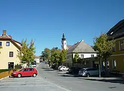
Sankt Leonhard am Hornerwald is a town in the district of Krems-Land in Lower Austria in Austria.
Population
| Year | Pop. | ±% |
|---|---|---|
| 1851 | 2,678 | — |
| 1923 | 2,225 | −16.9% |
| 1961 | 1,623 | −27.1% |
| 1971 | 1,545 | −4.8% |
| 1981 | 1,306 | −15.5% |
| 1991 | 1,217 | −6.8% |
| 2001 | 1,241 | +2.0% |
| 2009 | 1,158 | −6.7% |
References
- ↑ "Dauersiedlungsraum der Gemeinden Politischen Bezirke und Bundesländer - Gebietsstand 1.1.2018". Statistics Austria. Retrieved 10 March 2019.
- ↑ "Einwohnerzahl 1.1.2018 nach Gemeinden mit Status, Gebietsstand 1.1.2018". Statistics Austria. Retrieved 9 March 2019.

This article is issued from Wikipedia. The text is licensed under Creative Commons - Attribution - Sharealike. Additional terms may apply for the media files.