Sant Pol de Mar | |
|---|---|
 | |
_2.svg.png.webp) Coat of arms | |
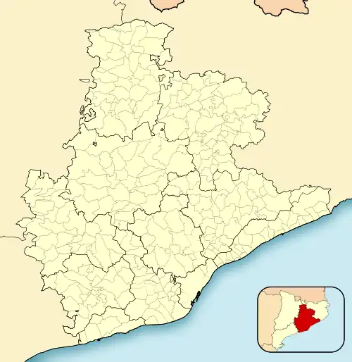 Sant Pol de Mar Location in Catalonia  Sant Pol de Mar Sant Pol de Mar (Spain) | |
| Coordinates: 41°36′12″N 2°37′28″E / 41.60333°N 2.62444°E | |
| Country | |
| Community | |
| Province | Barcelona |
| Comarca | Maresme |
| Government | |
| • Mayor | Montserrat Garrido Romera (2015)[1] |
| Area | |
| • Total | 7.5 km2 (2.9 sq mi) |
| Elevation | 15 m (49 ft) |
| Population (2018)[3] | |
| • Total | 5,178 |
| • Density | 690/km2 (1,800/sq mi) |
| Demonym | Santpolenc |
| Postal Code | 08395 |
| Website | santpol |
Sant Pol de Mar (Catalan pronunciation: [ˈsan ˈpɔl də ˈmaɾ]) is a municipality in the comarca of Maresme in Catalonia, Spain. It is located on the coast between Canet de Mar and Calella. The national highway N-II and a station on the RENFE railway line link Sant Pol de Mar to the rest of the coast, while a local road links the town with Arenys de Munt.
Twin towns
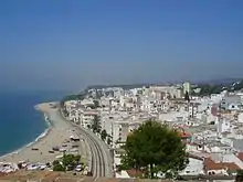
Sant Pol de Mar - view
Sources
- ↑ "Ajuntament de Sant Pol de Mar". Generalitat of Catalonia. Retrieved 2015-11-13.
- ↑ "El municipi en xifres: Sant Pol de Mar". Statistical Institute of Catalonia. Retrieved 2015-11-23.
- ↑ Municipal Register of Spain 2018. National Statistics Institute.
External links
Wikimedia Commons has media related to Sant Pol de Mar.
Wikivoyage has a travel guide for Sant Pol de Mar.
- Official website (in Catalan)
- Government data pages (in Catalan)
- Architectonical heritage in Sant Pol de Mar
Places adjacent to Sant Pol de Mar | ||||||||||||||||
|---|---|---|---|---|---|---|---|---|---|---|---|---|---|---|---|---|
| ||||||||||||||||
.svg.png.webp)
This article is issued from Wikipedia. The text is licensed under Creative Commons - Attribution - Sharealike. Additional terms may apply for the media files.