Santa Terezinha | |
|---|---|
Municipality | |
| The Municipality of Santa Terezinha | |
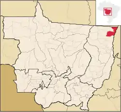 Location of Santa Terezinha | |
| Coordinates: 10°28′12″S 50°30′10″W / 10.47000°S 50.50278°W | |
| Country |  Brazil Brazil |
| Region | Central-West |
| State |  Mato Grosso Mato Grosso |
| Government | |
| • Mayor | Olivan Ferreira Trindade |
| Area | |
| • Total | 6.450.838 km2 (2.49 sq mi) |
| Elevation | 198 m (650 ft) |
| Population (2020 [1]) | |
| • Total | 8,460 |
| • Density | 1.0/km2 (3/sq mi) |
| Time zone | UTC−4 (AMT) |
| HDI (2000) | 0.665 – medium[2] |
Santa Terezinha is the easternmost municipality in the Brazilian state of Mato Grosso.
The city is served by Santa Terezinha Airport.
References
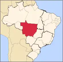
Capital: Cuiabá | |||||||||||||||||
| Centro-Sul Mato-Grossense |
|  | |||||||||||||||
| Nordeste Mato-Grossense |
| ||||||||||||||||
| Norte Mato-Grossense |
| ||||||||||||||||
| Sudeste Mato-Grossense |
| ||||||||||||||||
| Sudoeste Mato-Grossense |
| ||||||||||||||||
This article is issued from Wikipedia. The text is licensed under Creative Commons - Attribution - Sharealike. Additional terms may apply for the media files.