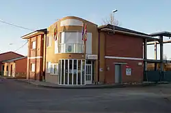
Santovenia de la Valdoncina, Spain | |
|---|---|
 | |
 Flag  Seal | |
 Santovenia de la Valdoncina, Spain Location in Spain | |
| Coordinates: 42°33′00″N 5°37′00″W / 42.55°N 5.6167°W | |
| Country | Spain |
| Autonomous community | Castile and León |
| Province | León |
| Municipality | Santovenia de la Valdoncina |
| Area | |
| • Total | 30 km2 (10 sq mi) |
| Elevation | 836 m (2,743 ft) |
| Population (2018)[1] | |
| • Total | 2,108 |
| • Density | 70/km2 (180/sq mi) |
| Time zone | UTC+1 (CET) |
| • Summer (DST) | UTC+2 (CEST) |
Santovenia de la Valdoncina (Spanish pronunciation: [santoˈβenja ðe la βaldonˈθina]) is a municipality located in the province of León, Castile and León, Spain. According to the 2004 census (INE), the municipality has a population of 1,774 inhabitants.
Towns
Quintana de Raneros; Ribaseca; Santovenia de la Valdoncina; Villacedré; Villanueva del Carnero
References
- ↑ Municipal Register of Spain 2018. National Statistics Institute.

This article is issued from Wikipedia. The text is licensed under Creative Commons - Attribution - Sharealike. Additional terms may apply for the media files.