Schleißheim | |
|---|---|
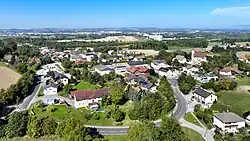 South view of Schleißheim | |
 Coat of arms | |
 Schleißheim Location within Austria | |
| Coordinates: 48°09′39″N 14°05′36″E / 48.16083°N 14.09333°E | |
| Country | Austria |
| State | Upper Austria |
| District | Wels-Land |
| Government | |
| • Mayor | Manfred Zauner (ÖVP) |
| Area | |
| • Total | 7.59 km2 (2.93 sq mi) |
| Elevation | 317 m (1,040 ft) |
| Population (2018-01-01)[2] | |
| • Total | 1,389 |
| • Density | 180/km2 (470/sq mi) |
| Time zone | UTC+1 (CET) |
| • Summer (DST) | UTC+2 (CEST) |
| Postal code | 4600 |
| Area code | 0 72 42 |
| Vehicle registration | WL |
| Website | www.schleissheim.at |
Schleißheim is a municipality in the district Wels-Land in the Austrian state of Upper Austria.
Population
| Year | Pop. | ±% |
|---|---|---|
| 1869 | 568 | — |
| 1880 | 565 | −0.5% |
| 1890 | 566 | +0.2% |
| 1900 | 532 | −6.0% |
| 1910 | 538 | +1.1% |
| 1923 | 568 | +5.6% |
| 1934 | 644 | +13.4% |
| 1939 | 613 | −4.8% |
| 1951 | 711 | +16.0% |
| 1961 | 590 | −17.0% |
| 1971 | 611 | +3.6% |
| 1981 | 749 | +22.6% |
| 1991 | 845 | +12.8% |
| 2001 | 938 | +11.0% |
| 2011 | 1,233 | +31.4% |
References
- ↑ "Dauersiedlungsraum der Gemeinden Politischen Bezirke und Bundesländer - Gebietsstand 1.1.2018". Statistics Austria. Retrieved 10 March 2019.
- ↑ "Einwohnerzahl 1.1.2018 nach Gemeinden mit Status, Gebietsstand 1.1.2018". Statistics Austria. Retrieved 9 March 2019.
Wikimedia Commons has media related to Schleißheim.
This article is issued from Wikipedia. The text is licensed under Creative Commons - Attribution - Sharealike. Additional terms may apply for the media files.