Schwarzau im Gebirge | |
|---|---|
village | |
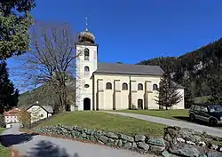 Schwarzau im Gebirge parish church | |
 Coat of arms | |
 Schwarzau im Gebirge Location within Austria | |
| Coordinates: 47°48′N 15°42′E / 47.800°N 15.700°E | |
| Country | Austria |
| State | Lower Austria |
| District | Neunkirchen |
| Government | |
| • Mayor | Michael Streif (SPÖ) |
| Area | |
| • Total | 190.44 km2 (73.53 sq mi) |
| Elevation | 617 m (2,024 ft) |
| Population (2018-01-01)[2] | |
| • Total | 644 |
| • Density | 3.4/km2 (8.8/sq mi) |
| Time zone | UTC+1 (CET) |
| • Summer (DST) | UTC+2 (CEST) |
| Postal code | 2662 |
| Area code | 02567 |
| Website | www.schwarzauimgebirge.at |
Schwarzau im Gebirge is a village in the district of Neunkirchen in the Austrian state of Lower Austria.
Population
| Year | Pop. | ±% |
|---|---|---|
| 1869 | 2,114 | — |
| 1880 | 2,008 | −5.0% |
| 1890 | 1,897 | −5.5% |
| 1900 | 1,869 | −1.5% |
| 1910 | 1,801 | −3.6% |
| 1923 | 1,598 | −11.3% |
| 1934 | 1,588 | −0.6% |
| 1939 | 1,478 | −6.9% |
| 1951 | 1,522 | +3.0% |
| 1961 | 1,317 | −13.5% |
| 1971 | 1,162 | −11.8% |
| 1981 | 966 | −16.9% |
| 1991 | 918 | −5.0% |
| 2001 | 831 | −9.5% |
| 2011 | 698 | −16.0% |
References
- ↑ "Dauersiedlungsraum der Gemeinden Politischen Bezirke und Bundesländer - Gebietsstand 1.1.2018". Statistics Austria. Retrieved 10 March 2019.
- ↑ "Einwohnerzahl 1.1.2018 nach Gemeinden mit Status, Gebietsstand 1.1.2018". Statistics Austria. Retrieved 9 March 2019.
External links
This article is issued from Wikipedia. The text is licensed under Creative Commons - Attribution - Sharealike. Additional terms may apply for the media files.