Sewu | |
|---|---|
Township | |
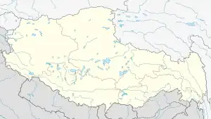 Sewu Location within Tibet | |
| Coordinates: 33°41′N 90°19′E / 33.68°N 90.31°E | |
| Country | China |
| Region | Tibet |
| Prefecture | Nagqu Prefecture |
| County | Amdo County |
| Area | |
| • Total | 5,647 km2 (2,180 sq mi) |
| Population (2004) | |
| • Total | 1,000 |
| • Major Nationalities | Tibetan |
| • Regional dialect | Tibetan language |
| Time zone | +8 |
Sewu, Sêwa or Sewuxiang (Chinese: 色务乡) is a village and township-level division of Amdo County in the Nagqu Prefecture of the Tibet Autonomous Region, in China. It lies near Qixiang Lake.[1] The township covers an area of 5,647 kilometres (3,509 mi) and in 2004 it had a population of about 1,000.[2] The principal economic activity is animal husbandry, pastoral yak, goat, sheep, and so on.[3]
Administrative divisions
The township-level division contains the following villages:[2]
- Meijiegang Village (美接岗村)
- Sangguo Village (桑果村)
- Bamu Luozong Village (巴姆罗宗村)
- Mamao Xuna Village (玛毛许那村)
See also
References
- ↑ Maps (Map). Google Maps.
- 1 2 "Sewu Township". CF Guide. Retrieved 29 May 2012.
- ↑ 色务乡 (in Chinese). Chinaquhua.cn. Retrieved 29 May 2012.
| District | 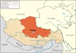 | |
|---|---|---|
| Counties | ||
| Towns and villages |
| |
| Geography |
| |
This article is issued from Wikipedia. The text is licensed under Creative Commons - Attribution - Sharealike. Additional terms may apply for the media files.