Shahba District
منطقة شهبا | |
|---|---|
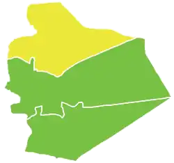 Map of Shahba' District within as-Suwayda Governorate | |
| Coordinates (Shahba): 32°51′15″N 36°37′45″E / 32.8542°N 36.6292°E | |
| Country | |
| Governorate | as-Suwayda |
| Seat | Shahba |
| Subdistricts | 4 nawāḥī |
| Area | |
| • Total | 1,773.13 km2 (684.61 sq mi) |
| Population (2004)[1] | |
| • Total | 71,949 |
| • Density | 41/km2 (110/sq mi) |
| Geocode | SY1303 |
Shahba District (Arabic: منطقة شهبا, romanized: manṭiqat Šahbā) is a district of the as-Suwayda Governorate in southern Syria. The administrative centre is the city of Shahba. At the 2004 census, the district had a population of 71,949.[1]
Sub-districts
The district of Shahba is divided into four sub-districts or nawāḥī (population as of 2004[1]):
| Code | Name | Area | Population |
|---|---|---|---|
| SY130300 | Shahba Subdistrict | 263.88 km2 | 31,657 |
| SY130301 | Shaqqa Subdistrict | 731.29 km2 | 15,849 |
| SY130302 | al-Ariqah Subdistrict | 204.20 km2 | 11,723 |
| SY130303 | al-Surah al-Saghirah Subdistrict | 573.76 km2 | 12,720 |
See also
References
- 1 2 3 "General Census of Population and Housing 2004" (PDF) (in Arabic). Syrian Central Bureau of Statistics. Retrieved 15 October 2015. Also available in English: "2004 Census Data". UN OCHA. Retrieved 15 October 2015.
| |||||||||||||||
| |||||||||||||||
| |||||||||||||||
This article is issued from Wikipedia. The text is licensed under Creative Commons - Attribution - Sharealike. Additional terms may apply for the media files.