Siuri
सिउरी | |
|---|---|
 Siuri Location in Nepal | |
| Coordinates: 28°20′N 82°49′E / 28.34°N 82.82°E | |
| Country | |
| Zone | Rapti Zone |
| District | Rolpa District |
| Population (1991) | |
| • Total | 2,801 |
| Time zone | UTC+5:45 (Nepal Time) |
Siuri is a village development committee in Rolpa District in the Rapti Zone of north-eastern Nepal. At the time of the 1991 Nepal census it had a population of 1659 people living in 303 individual households.[1]
References
- ↑ "Nepal Census 2001". Nepal's Village Development Committees. Digital Himalaya. Retrieved 12 December 2008.
Headquarter: Rolpa | ||
| Municipality | 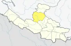 | |
| Rural Municipality | ||
| Former Rural units (VDCs) |
| |
This article is issued from Wikipedia. The text is licensed under Creative Commons - Attribution - Sharealike. Additional terms may apply for the media files.