Solivella | |
|---|---|
 | |
 Flag  Coat of arms | |
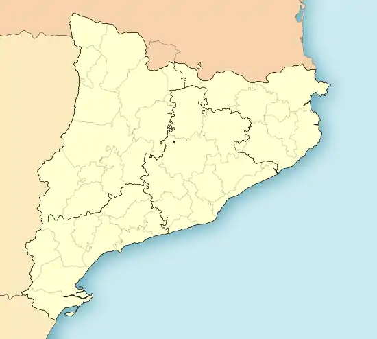 Solivella Location in Catalonia | |
| Coordinates: 41°27′33″N 1°10′43″E / 41.45917°N 1.17861°E | |
| Country | |
| Community | |
| Province | |
| Comarca | |
| Government | |
| • Mayor | Enric Capdevila Torres (2015)[1] |
| Area | |
| • Total | 21.4 km2 (8.3 sq mi) |
| Elevation | 489 m (1,604 ft) |
| Population (2018)[3] | |
| • Total | 619 |
| • Density | 29/km2 (75/sq mi) |
| Demonym | Solivellenc |
| Website | www |
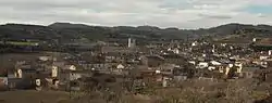
Solivella is a municipality in the comarca of the Conca de Barberà in Catalonia, Spain.
Mentioned for the first time in a document from 1058, it rose around a castle, of which today only ruins remain. It was a possession of the Monastery of Santes Creus, and in 1393 it went to the Catalan crown.
The medieval Sanctuary of Tallat is located nearby, between Solivella and Belltall.
References
- ↑ "Ajuntament de Solivella". Generalitat of Catalonia. Retrieved 2015-11-13.
- ↑ "El municipi en xifres: Solivella". Statistical Institute of Catalonia. Retrieved 2015-11-23.
- ↑ Municipal Register of Spain 2018. National Statistics Institute.
External links
Wikimedia Commons has media related to Solivella.
- Official website (in Catalan)
- Government data pages (in Catalan)
Places adjacent to Solivella | |
|---|---|
Municipalities of Conca de Barberà | ||
|---|---|---|
This article is issued from Wikipedia. The text is licensed under Creative Commons - Attribution - Sharealike. Additional terms may apply for the media files.