Spindletop | |
|---|---|
Neighborhood of Lexington, Kentucky | |
| Coordinates: 38°08′06″N 84°31′34″W / 38.135°N 84.526°W | |
| Country | United States |
| State | Kentucky |
| County | Fayette |
| City | Lexington |
| Area | |
| • Total | 0.321 sq mi (0.83 km2) |
| Population (2000) | |
| • Total | 126 |
| • Density | 393/sq mi (152/km2) |
| Time zone | UTC-5 (Eastern (EST)) |
| • Summer (DST) | UTC-4 (EDT) |
| ZIP code | 40511 |
| Area code | 859 |
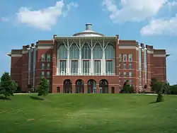
Spindletop is a rural neighborhood north of Lexington, Kentucky, United States. Its boundaries are I-75 to the west and Berea Road to the south and east. It is located just south of the Kentucky Horse Park.[1] It is named for Spindletop hall, a historic mansion once owned by Miles Franklin Yount, which is located within the neighborhood.[2]
Neighborhood statistics
- Area: 0.321 square miles (0.83 km2)
- Population: 126
- Population density: 393 people per square mile
- Median household income: $57,604[1]
References
- 1 2 Spindletop Neighborhood Profile Retrieved on 2013-01-06
- ↑ A History of Spindletop Hall Retrieved 2013-01-06


This article is issued from Wikipedia. The text is licensed under Creative Commons - Attribution - Sharealike. Additional terms may apply for the media files.