Springfield Township, Cedar County | |
|---|---|
 | |
| Coordinates: 41°49′16″N 090°57′56″W / 41.82111°N 90.96556°W | |
| Country | |
| State | |
| County | Cedar |
| Area | |
| • Total | 37.66 sq mi (97.54 km2) |
| • Land | 37.66 sq mi (97.54 km2) |
| • Water | 0 sq mi (0 km2) |
| Elevation | 768 ft (234 m) |
| Population (2000) | |
| • Total | 1,138 |
| • Density | 30.2/sq mi (11.7/km2) |
| FIPS code | 19-93978[2] |
| GNIS feature ID | 0468740 |
Springfield Township is one of seventeen townships in Cedar County, Iowa, USA. As of the 2000 census, its population was 1,138.
History
Springfield Township was organized in 1841.[3] The first school building in Springfield Township was built in 1848.[4]
Geography
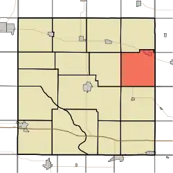
Springfield Township covers an area of 37.66 square miles (97.5 km2) and contains one incorporated settlement, Lowden. According to the USGS, it contains five cemeteries: Elliott Parr Grave, Fairview, Lowden, Van Horn and Zion Church.
References
- ↑ "US Board on Geographic Names". United States Geological Survey. October 25, 2007. Retrieved January 31, 2008.
- ↑ "U.S. Census website". United States Census Bureau. Retrieved January 31, 2008.
- ↑ The History of Cedar County, Iowa: Containing a History of the County, Its Cities, Towns, etc. Western Historical Company. 1878. p. 385.
- ↑ Aurner, Clarence Ray (1910). A Topical History of Cedar County, Iowa, Volume 1. S. J. Clarke. pp. 175.
External links
Municipalities and communities of Cedar County, Iowa, United States | ||
|---|---|---|
| Cities | Map of Iowa highlighting Cedar County | |
| Townships | ||
| CDPs | ||
| Other communities | ||
| Footnotes | ‡This populated place also has portions in an adjacent county or counties | |
This article is issued from Wikipedia. The text is licensed under Creative Commons - Attribution - Sharealike. Additional terms may apply for the media files.