Stegen | |
|---|---|
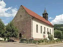 Church of Saint James in Eschbach | |
 Coat of arms | |
Location of Stegen within Breisgau-Hochschwarzwald district 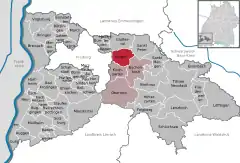 | |
 Stegen  Stegen | |
| Coordinates: 47°58′58″N 7°57′50″E / 47.98278°N 7.96389°E | |
| Country | Germany |
| State | Baden-Württemberg |
| Admin. region | Freiburg |
| District | Breisgau-Hochschwarzwald |
| Subdivisions | 3 |
| Government | |
| • Mayor (2015–23) | Fränzi Kleeb[1] |
| Area | |
| • Total | 26.32 km2 (10.16 sq mi) |
| Elevation | 408 m (1,339 ft) |
| Population (2021-12-31)[2] | |
| • Total | 4,542 |
| • Density | 170/km2 (450/sq mi) |
| Time zone | UTC+01:00 (CET) |
| • Summer (DST) | UTC+02:00 (CEST) |
| Postal codes | 79252 |
| Dialling codes | 07661 |
| Vehicle registration | FR |
| Website | www.dreisamportal.de |
Stegen is a municipality in the Breisgau-Hochschwarzwald district, Baden-Württemberg, Germany. It borders on the city of Freiburg, being about 8 km away as the crow flies, lying in the valley of the river Dreisam. The municipality includes three population centres: the town of Stegen (which itself includes the villages of Weiler, Oberbirken, Unterbirken and Rechtenbach) and the villages of Eschbach and Wittental.
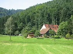
Economically, Stegen is partly an offshoot of Freiburg; for example, the Forest Zoology Institute of the University of Freiburg maintains a field station at Wittental. It also plays a role in Black Forest tourism, with guest houses and other facilities catering to visitors. It is the first town that a hiker on the Freiburg-Lake Constance Black Forest Trail passes through when travelling eastwards on the path from Freiburg.
References
- ↑ Aktuelle Wahlergebnisse, Staatsanzeiger, accessed 11 September 2021.
- ↑ "Bevölkerung nach Nationalität und Geschlecht am 31. Dezember 2021" [Population by nationality and sex as of December 31, 2021] (CSV) (in German). Statistisches Landesamt Baden-Württemberg. June 2022.