Stotonic Village, Arizona
O'odham: S-totoñigk | |
|---|---|
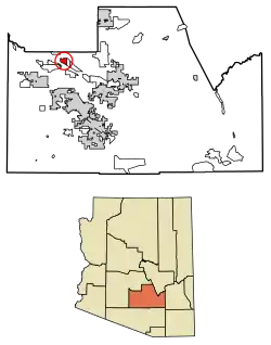 Location of Stotonic Village in Pinal County, Arizona. | |
| Country | United States |
| State | Arizona |
| County | Pinal |
| Area | |
| • Total | 5.11 sq mi (13.23 km2) |
| • Land | 5.11 sq mi (13.23 km2) |
| • Water | 0.00 sq mi (0.00 km2) |
| Population (2020) | |
| • Total | 610 |
| • Density | 119.40/sq mi (46.10/km2) |
| Time zone | UTC-7 (MST (no DST)) |
| ZIP code | 85128[2] |
| Area code | 520 |
| FIPS code | 04-69872 |
Stotonic (O'odham: S-totoñigk) is a census-designated place (CDP) in Pinal County, Arizona, United States, located in the Gila River Indian Community. The population was 659 at the 2010 census. Stotonic Village has a median household income of $2,499 – the lowest of any CDP in Arizona
Demographics
| Census | Pop. | Note | %± |
|---|---|---|---|
| 2020 | 610 | — | |
| U.S. Decennial Census[3] | |||
As of the census[4] of 2010, there were 659 people living in the CDP. The population density was 133.0 people per square mile. The racial makeup of the CDP was 2.6% White, 0.6% Black or African American, 92.6% Native American, 0.2% Pacific Islander, 1.1% from other races, and 3.0% from two or more races. 15.5% of the population were Hispanic or Latino of any race.
Notes
- ↑ "2020 U.S. Gazetteer Files". United States Census Bureau. Retrieved October 29, 2021.
- ↑ "Stotonic Village AZ ZIP Code". zipdatamaps.com. 2023. Retrieved May 3, 2023.
- ↑ "Census of Population and Housing". Census.gov. Retrieved June 4, 2016.
- ↑ United States Census
- Stotonic Village CDP 33°09′10″N 111°49′00″W / 33.15278°N 111.81667°W
- U.S. Geological Survey Geographic Names Information System: Stotonic (Populated Place)
Municipalities and communities of Pinal County, Arizona, United States | ||
|---|---|---|
| Cities | 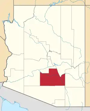 | |
| Towns | ||
| CDPs |
| |
| Populated places | ||
| Indian reservations | ||
| Ghost towns | ||
| Footnotes | ‡This populated place also has portions in an adjacent county or counties | |
This article is issued from Wikipedia. The text is licensed under Creative Commons - Attribution - Sharealike. Additional terms may apply for the media files.