Schrunk Township, North Dakota | |
|---|---|
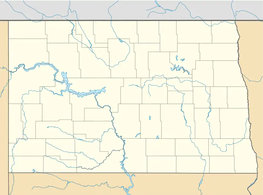 Schrunk Township, North Dakota Location within the state of North Dakota | |
| Coordinates: 47°17′53″N 100°25′55″W / 47.29806°N 100.43194°W | |
| Country | United States |
| State | North Dakota |
| County | Dickey |
| Area | |
| • Total | 34.38 sq mi (89.0 km2) |
| • Land | 32.66 sq mi (84.6 km2) |
| • Water | 1.72 sq mi (4.5 km2) |
| Elevation | 1,939 ft (591 m) |
| Population (2000) | |
| • Total | 26 |
| • Density | 0.8/sq mi (0.3/km2) |
| Time zone | UTC-6 (Central (CST)) |
| • Summer (DST) | UTC-5 (CDT) |
| Area code | 701 |
| FIPS code | 38-71220[2] |
| GNIS feature ID | 1759345[3] |
Schrunk Township is a civil township in Burleigh County in the U.S. state of North Dakota. As of the 2000 census, its population was 26,[4] but had increased to an estimated 71 by 2009.[5]
History
Schrunk Township was first listed as a school township during the 1910 Census, with a population of 120.[6] It was named after brothers Charlie and George Schrunk, early settlers from Iowa who moved to the area in 1893. The first school was built in 1903. A second schoolhouse was constructed in 1908, and operated until 1957 when the school district was consolidated with nearby Wing.[7]
It was later organized as a civil township under the name Summit, and reported a 1920 population of 131.[7][8] By the time of the 1908 Census, the township had been renamed Schrunk.[7][9]
External links
References
- ↑ U.S. Census Bureau. Census 2000, Summary File 1. "GCT-PH1. Population, Housing Units, Area, and Density: 2000 - County -- Subdivision and Place". American FactFinder. <http://factfinder2.census.gov>. Retrieved January 31, 2008.
{{cite web}}: CS1 maint: numeric names: authors list (link) - ↑ "U.S. Census website". United States Census Bureau. Retrieved January 31, 2008.
- ↑ "US Board on Geographic Names". United States Geological Survey. October 25, 2007. Retrieved January 31, 2008.
- ↑
U.S. Census Bureau. Census 2000. "Census Demographic Profiles, Schrunk Township" (PDF). CenStats Databases. Retrieved January 31, 2009.
{{cite web}}: CS1 maint: numeric names: authors list (link) - ↑ U.S. Census Bureau (2010). "Incorporated Places and Minor Civil Divisions: North Dakota". 2009 Population Estimates. Archived from the original (CSV) on June 27, 2010. Retrieved June 22, 2010.
- ↑ U.S. Census Bureau (1913). "Number of Inhabitants, North Dakota" (PDF). Thirteenth Census of the United States: 1910. Government Printing Office. Retrieved July 20, 2008.
- 1 2 3 Bismarck-Mandan Genealogical and Historical Society (1978). Bauman, Beth Hughes and Dorothy J. Jackaman (ed.). Burleigh County: Prairie Trails to Hi-Ways. Dallas, Texas: Taylor Publishing Co. p. 499. OCLC 4478394.
- ↑ U.S. Census Bureau (1921). "Number and Distribution of Inhabitants, North Dakota" (PDF). Fourteenth Census of the United States: 1920. Government Printing Office. Retrieved July 20, 2008.
- ↑ U.S. Census Bureau (1981). "Number of Inhabitants, North Dakota" (PDF). 1980 Census of Population and Housing. Government Printing Office. Retrieved July 20, 2008.
Municipalities and communities of Burleigh County, North Dakota, United States | ||
|---|---|---|
| Cities | 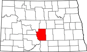 Map of North Dakota highlighting Burleigh County | |
| Townships |
| |
| Unorganized territories |
| |
| CDPs | ||
| Other communities | ||
| Ghost town | ||
| Footnotes | ‡This populated place also has portions in an adjacent county or counties | |