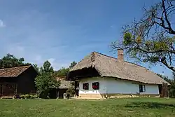
Szalafő | |
|---|---|
 | |
 Szalafő Location of Szalafő in Hungary | |
| Coordinates: 46°52′13.37″N 16°21′20.45″E / 46.8703806°N 16.3556806°E | |
| Country | Hungary |
| Region | Western Transdanubia |
| County | Vas |
| Subregion | Őriszentpéteri |
| Rank | Village |
| Area | |
| • Total | 27.37 km2 (10.57 sq mi) |
| Time zone | UTC+1 (CET) |
| • Summer (DST) | UTC+2 (CEST) |
| Postal code | 9942 |
| Area code | +36 94 |
| Website | www.szalafo.hu |
Szalafő (Slovene: Sola[2] or Glava Zale[3][4]) is a village in Vas county, Hungary.
References
- ↑ Szalafő at the Hungarian Central Statistical Office (Hungarian).
- ↑ Kozar-Mukič, Marija (1984). Slovensko Porabje. Ljubljana: Znanstveni inštitut Filozofske fakultete. p. 85.
- ↑ Marton, Jenő; Mózes, Krisztián; Wenszky, Nóra (2018). On two wheels without borders / Auf zwei Rädern ohne Grenzen. Budapest: Hibernia. p. 94.
- ↑ "Szalafő (Glava Zale)". Geopedia. Retrieved November 2, 2019.
46°52′N 16°22′E / 46.867°N 16.367°E
This article is issued from Wikipedia. The text is licensed under Creative Commons - Attribution - Sharealike. Additional terms may apply for the media files.