| Têt | |
|---|---|
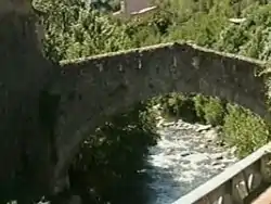 Têt near Villefranche-de-Conflent | |
.png.webp) | |
| Native name | La Têt (French) |
| Location | |
| Country | France |
| Physical characteristics | |
| Source | |
| • location | Pyrenees |
| • elevation | ±2,400 m (7,900 ft) |
| Mouth | |
• location | Mediterranean Sea |
• coordinates | 42°42′48″N 3°2′23″E / 42.71333°N 3.03972°E |
| Length | 115 km (71 mi) |
| Basin size | 1,550 km2 (600 sq mi) |
| Discharge | |
| • average | 7.5 m3/s (260 cu ft/s) |
The Têt (French: [tɛt] ⓘ; Catalan: Tet) is the largest river in Pyrénées-Orientales, southwestern France. It is 115 kilometres (71 mi) long.[1] The Têt has its source at the foot of the Puig de la Cometa de l'Espagne in the Carlit massif in the eastern Pyrenees. It crosses the Pyrénées-Orientales département (Northern Catalonia) from West to East and ends in the Mediterranean Sea, near Perpignan (Catalan: Perpinyà).[2]
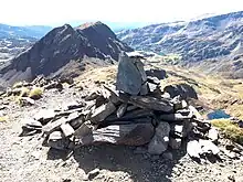
Puig de la Cometa de l'Espagne (2,763m). Below, on the right: the upper part of the Têt valley (here known as the vallée de la Grava).
Tributaries include
Towns along the river
- Mont-Louis (Montlluís)
- Olette (Oleta)
- Villefranche-de-Conflent (Vilafranca de Conflent)
- Prades (Prada de Conflent)
- Perpignan (Perpinyà)
- Ille-sur-Têt (Illa)
References
Wikimedia Commons has media related to Têt.
This article is issued from Wikipedia. The text is licensed under Creative Commons - Attribution - Sharealike. Additional terms may apply for the media files.