Tabbaya
عرب طبايا | |
|---|---|
Village | |
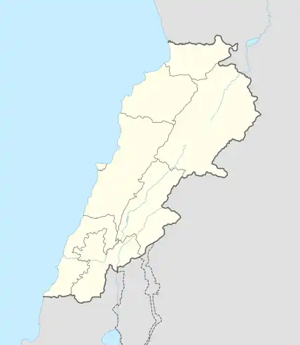 Tabbaya Location in Lebanon | |
| Coordinates: 33°29′15″N 35°26′24″E / 33.48750°N 35.44000°E | |
| Country | |
| Governorate | South Governorate |
| District | Sidon District |
| Area | |
| • Total | 0.71 sq mi (1.8 km2) |
| Elevation | 1,300 ft (400 m) |
| Time zone | UTC+2 (EET) |
| • Summer (DST) | UTC+3 (EEST) |
Tabbaya, Tobbaya, طبايا (Arabic: طبايا) is a local authority in the South Governorate in Lebanon. It is located 57 km south of Beirut[1] and 15 km southeast of Sidon. It is 10 km inland from the Mediterranean, occupying a hill with elevation ranging between 400 and 410 meters above sea level.
References
- 1 2 3 Aarab Tabbaya, localiban
External links
- Aarab Tabbaya, Localiban
| Capital | 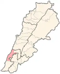 | |
|---|---|---|
| Towns and villages |
| |
| Palestinian refugee camps | ||
| Other | ||
This article is issued from Wikipedia. The text is licensed under Creative Commons - Attribution - Sharealike. Additional terms may apply for the media files.