Tangier, Oklahoma | |
|---|---|
 Tangier, Oklahoma | |
| Coordinates: 36°25′15″N 99°32′00″W / 36.42083°N 99.53333°W | |
| Country | United States |
| State | Oklahoma |
| County | Woodward |
| Elevation | 2,192 ft (668 m) |
| Time zone | UTC-6 (Central (CST)) |
| • Summer (DST) | UTC-5 (CDT) |
| Area code | 580 |
| GNIS feature ID | 1100875[1] |
Tangier is an unincorporated community in Woodward County, Oklahoma, United States.[1][2] During the 1940s, there was a bentonite plant located two miles east of Tangier.[2]
References
- 1 2 3 U.S. Geological Survey Geographic Names Information System: Tangier, Oklahoma
- 1 2 Everett, Dianna. "Woodward County," Encyclopedia of Oklahoma History and Culture, Oklahoma Historical Society, Accessed September 23, 2015.
Municipalities and communities of Woodward County, Oklahoma, United States | ||
|---|---|---|
| City | 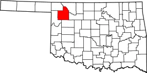 Map of Oklahoma highlighting Woodward County | |
| Towns | ||
| CDP | ||
| Other community | ||
This article is issued from Wikipedia. The text is licensed under Creative Commons - Attribution - Sharealike. Additional terms may apply for the media files.