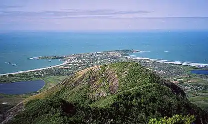
Fort-Dauphin district
Taolagnaro district, Tolagnaro | |
|---|---|
 | |
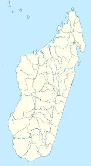 Fort-Dauphin district Location of Fort-Dauphin in Madagascar | |
| Coordinates: 25°01′57″S 46°59′00″E / 25.03250°S 46.98333°E[1] | |
| Country | Madagascar |
| Region | Anosy |
| Elevation | 27 m (89 ft) |
| Time zone | East Africa Time (GMT+3) |
| Postal code | 614 |
The district of Taolagnaro (or: Fort Dauphin district) is a district of Anosy in Madagascar.[2][3]
Communes
The district is further divided into 24 communes:
Nature
- Lavasoa-Ambatotsirongorongo Mountains, 30 km west of Fort Dauphin (Ranopiso, Ankaramena, Sarasambo)[4]
- Sainte Luce Reserve
- Andohahela National Park
- Tsitongambarika forest in Ampasy Nahampoa.
Roads
- the National Road 12a, from Fort-Dauphin to Vangaindrano.
- the National Road 13, from Fort-Dauphin to Ambovombe and Ihosy.
Airport
Seaport
References
- ↑ Tolanaro in Geonames.org (cc-by)
- ↑ REPOBLIKAN’I MADAGASIKARA:Tanindrazana – Fahafahana – Fandrosoana (PDF). MINISTERE DE L’AGRICULTURE, DE L’ELEVAGE ET DE LA PECHE. October 2007. pp. 42–44.
- ↑ "Madagascar: Administrative Division". citypopulation. Retrieved 10 June 2018.
- ↑ Ambatotsirongorongo Forest project
Capital: Fort Dauphin (Taolagnaro) | ||
| Amboasary Sud (18) - 603 |
| 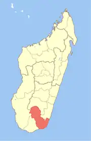 |
| Betroka (20) - 613 | ||
| Taolagnaro (24) - 614 | ||
3 districts; 62 communes | ||
This article is issued from Wikipedia. The text is licensed under Creative Commons - Attribution - Sharealike. Additional terms may apply for the media files.