Soanierana | |
|---|---|
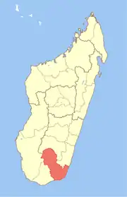
 Soanierana Location in Madagascar | |
| Coordinates: 25°0′S 46°53′E / 25.000°S 46.883°E | |
| Country | |
| Region | Anosy |
| District | Taolanaro |
| Area | |
| • Total | 606 km2 (234 sq mi) |
| Elevation | 35 m (115 ft) |
| Population (2001)[3] | |
| • Total | 9,000 |
| Time zone | UTC3 (EAT) |
| Postal code | 614 |
Soanierana is a rural municipality in Madagascar. It belongs to the district of Taolanaro, which is a part of Anosy Region. The population of the commune was estimated to be approximately 9,000 in 2001 commune census.[3]
Only primary schooling is available. The majority 64% of the population of the commune are farmers, while an additional 5% receives their livelihood from raising livestock. The most important crop is rice, while other important products are cassava and sweet potatoes. Industry and services provide employment for 2% and 10% of the population, respectively. Additionally fishing employs 19% of the population.[3]
Roads
This municipality is crossed by the Provincial road RIP118.[4]
References
- ↑ Projet RIP 118
- ↑ Estimated based on DEM data from Shuttle Radar Topography Mission
- 1 2 3 "ILO census data". Cornell University. 2002. Retrieved 2008-05-04.
- ↑ PROJET DE REHABILITATION DE LA RIP 118
Capital: Fort Dauphin (Taolagnaro) | ||
| Amboasary Sud (18) - 603 |
|  |
| Betroka (20) - 613 | ||
| Taolagnaro (24) - 614 | ||
3 districts; 62 communes | ||
This article is issued from Wikipedia. The text is licensed under Creative Commons - Attribution - Sharealike. Additional terms may apply for the media files.