Terra Boa | |
|---|---|
 Flag | |
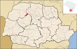 Location in Paraná state | |
 Terra Boa Location in Brazil | |
| Coordinates: 23°46′04″S 52°26′38″W / 23.76778°S 52.44389°W | |
| Country | Brazil |
| Region | South |
| State | Paraná |
| Mesoregion | Centro Ocidental Paranaense |
| Microregion | Campo Mourão |
| Area | |
| • Total | 320.85 km2 (123.88 sq mi) |
| Elevation | 825 m (2,707 ft) |
| Population (2020 [1]) | |
| • Total | 17,200 |
| • Density | 54/km2 (140/sq mi) |
| Time zone | UTC−3 (BRT) |
| Postal code | 87240-xxx |
Terra Boa is a municipality in the micro-region of Campo Mourão in the Brazilian state of Paraná. The population is 17,200 (2020 est.) in an area of 320.85 km².[2] The elevation is 825 m. The neighbouring municipalities are Cianorte, Engenheiro Beltrão, Jussara and Peabiru.
References
External links
- http://www.citybrazil.com.br/pr/terraboa (in Portuguese)
This article is issued from Wikipedia. The text is licensed under Creative Commons - Attribution - Sharealike. Additional terms may apply for the media files.