Teshikaga
弟子屈町 | |
|---|---|
Town | |
 Teshikaga town hall | |
 Flag  Seal | |
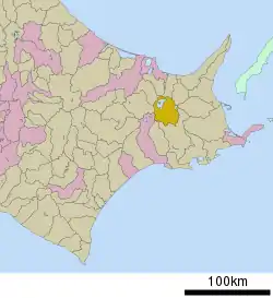 Location of Teshikaga in Hokkaido (Kushiro Subprefecture) | |
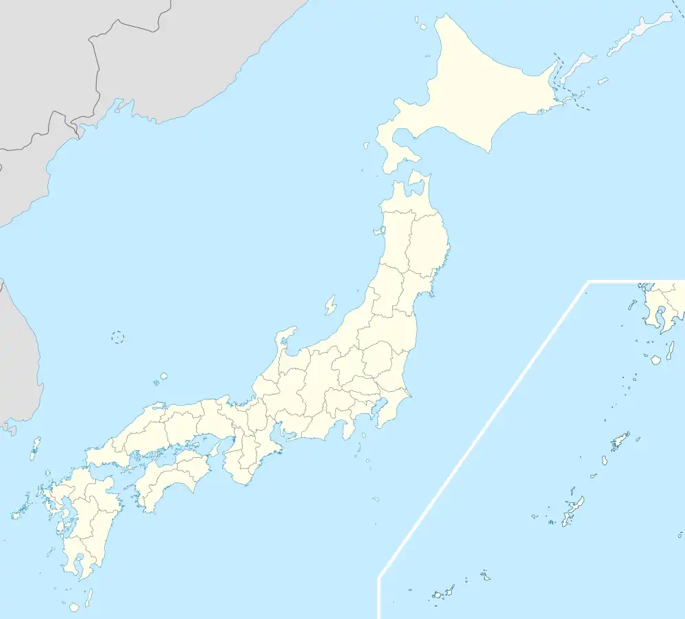 Teshikaga Location in Japan | |
| Coordinates: 43°29′N 144°28′E / 43.483°N 144.467°E | |
| Country | Japan |
| Region | Hokkaido |
| Prefecture | Hokkaido (Kushiro Subprefecture) |
| District | Kawakami |
| Area | |
| • Total | 774.53 km2 (299.05 sq mi) |
| Population (October 1, 2020) | |
| • Total | 6,955 |
| • Density | 9.0/km2 (23/sq mi) |
| Time zone | UTC+09:00 (JST) |
| Postal code | 088-3292 |
| Climate | Dfb |
| Website | www |
Teshikaga (弟子屈町, Teshikaga-chō) is a town located in Kushiro Subprefecture, Hokkaido, Japan. As of October 2020, the town has an estimated population of 6,955 and a density of 9.0 persons per km2.[1] The total area is 774.53 km2.
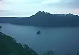
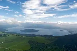
Tourist attractions in the town include Lake Mashū (Ainu: Kamuy-to), Lake Kussharo (Ainu: Kutcar or Kutcaro) and Kawayu Onsen.
History
- 1923: Teshikaga Village is formed.
- 1947: Teshikaga Village becomes Techikaga Town.
Climate
| Climate data for Teshikaga (1991−2020 normals, extremes 1977−present) | |||||||||||||
|---|---|---|---|---|---|---|---|---|---|---|---|---|---|
| Month | Jan | Feb | Mar | Apr | May | Jun | Jul | Aug | Sep | Oct | Nov | Dec | Year |
| Record high °C (°F) | 6.2 (43.2) |
7.6 (45.7) |
16.4 (61.5) |
27.5 (81.5) |
35.7 (96.3) |
33.7 (92.7) |
34.4 (93.9) |
34.4 (93.9) |
31.3 (88.3) |
24.7 (76.5) |
19.1 (66.4) |
12.9 (55.2) |
35.7 (96.3) |
| Mean daily maximum °C (°F) | −3.1 (26.4) |
−2.7 (27.1) |
1.4 (34.5) |
8.2 (46.8) |
14.6 (58.3) |
17.8 (64.0) |
21.2 (70.2) |
22.4 (72.3) |
19.6 (67.3) |
14.1 (57.4) |
6.9 (44.4) |
−0.2 (31.6) |
10.0 (50.0) |
| Daily mean °C (°F) | −7.2 (19.0) |
−7.1 (19.2) |
−2.9 (26.8) |
2.8 (37.0) |
8.5 (47.3) |
12.5 (54.5) |
16.4 (61.5) |
17.9 (64.2) |
14.9 (58.8) |
8.9 (48.0) |
2.1 (35.8) |
−4.5 (23.9) |
5.2 (41.3) |
| Mean daily minimum °C (°F) | −12.6 (9.3) |
−12.7 (9.1) |
−8.0 (17.6) |
−2.2 (28.0) |
3.1 (37.6) |
8.1 (46.6) |
12.7 (54.9) |
14.3 (57.7) |
10.6 (51.1) |
3.4 (38.1) |
−3.2 (26.2) |
−9.9 (14.2) |
0.3 (32.5) |
| Record low °C (°F) | −23.1 (−9.6) |
−26.7 (−16.1) |
−21.1 (−6.0) |
−14.7 (5.5) |
−5.3 (22.5) |
−0.9 (30.4) |
2.0 (35.6) |
5.6 (42.1) |
−1.0 (30.2) |
−8.0 (17.6) |
−16.3 (2.7) |
−21.4 (−6.5) |
−26.7 (−16.1) |
| Average precipitation mm (inches) | 50.6 (1.99) |
43.4 (1.71) |
64.5 (2.54) |
82.3 (3.24) |
99.9 (3.93) |
80.2 (3.16) |
106.2 (4.18) |
154.3 (6.07) |
154.1 (6.07) |
119.2 (4.69) |
71.6 (2.82) |
66.0 (2.60) |
1,092.3 (43.00) |
| Average precipitation days (≥ 1.0 mm) | 9.4 | 7.7 | 9.6 | 10.6 | 10.4 | 9.4 | 11.1 | 11.9 | 12.1 | 10.1 | 9.3 | 9.6 | 121.2 |
| Mean monthly sunshine hours | 134.2 | 139.7 | 163.6 | 157.7 | 162.7 | 133.2 | 108.4 | 115.6 | 131.3 | 150.7 | 134.4 | 132.9 | 1,664.4 |
| Source: Japan Meteorological Agency[2][3] | |||||||||||||
Notable people from Teshikaga
- Taiho Koki - sumo wrestler (born on Sakhalin but moved to Teshikaga aged 5)
- Kotogatake Koichi - sumo wrestler
Gallery
References
- ↑ "Teshikaga (Hokkaidō , Japan) - Population Statistics, Charts, Map, Location, Weather and Web Information". www.citypopulation.de. Retrieved 2024-01-04.
- ↑ 観測史上1~10位の値(年間を通じての値). JMA. Retrieved March 3, 2022.
- ↑ 気象庁 / 平年値(年・月ごとの値). JMA. Retrieved March 3, 2022.
External links
 Media related to Teshikaga, Hokkaidō at Wikimedia Commons
- Official Website (in Japanese)
| ||||||||||||
| ||||||||||||
| ||||||||||||
| ||||||||||||
| ||||||||||||
| ||||||||||||
| ||||||||||||
| ||||||||||||
| ||||||||||||
| ||||||||||||
| ||||||||||||
| ||||||||||||
| ||||||||||||
| ||||||||||||
This article is issued from Wikipedia. The text is licensed under Creative Commons - Attribution - Sharealike. Additional terms may apply for the media files.