Tha Pho Si
ท่าโพธิ์ศรี | |
|---|---|
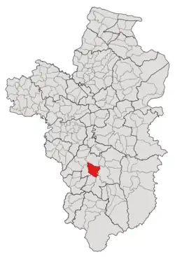 Subdistrict location in Ubon Ratchathani province | |
| Country | Thailand |
| Province | Ubon Ratchathani |
| District | Det Udom |
| Mubans | 8 |
| Number of Mu | 11 |
| Subdistrict established | 1976 |
| Area | |
| • Total | 69 km2 (27 sq mi) |
| Population (2021) | |
| • Total | 7,056 |
| • Density | 102.26/km2 (264.9/sq mi) |
| Time zone | UTC+7 (ICT) |
| Postal code | 34160 |
Tha Pho Si (Thai: ท่าโพธิ์ศรี) is a tambon (subdistrict) located in the central region of Det Udom District, in Ubon Ratchathani Province, Thailand.[1][2] In 2021, it had a population of 7,056 people.[2] Neighbouring subdistricts are (clockwise from the south) Top Hu, Non Sombun, Na Charoen, Mueang Det, and Klang.[1]
History
The area was first settled in the late 1800s, with the first village, Bak Waeng (บักแหว่ง), governed by Mueang Det, the district capital.[1] The settlement was eventually renamed "Tha Pho Si" in 1902, after the giant sandbox tree (Thai: โพธิ์ศรี; Pho Si) that was founded near the waterfront pavilion on the bank of the Lam Dom Yai River.[1]
The Tha Pho Si subdistrict was formed in 1976 by combining two areas splitting from Mueang Det and Klang, which consisted of five and one villages, respectively.[3]
Geography
The tambon is located in the central region of the Det Udom district, on the low river plain of the Lam Dom Yai River.[1]
Administration
The Tha Pho Si subdistrict is divided into eight administrative villages (mubans; หมู่บ้าน), one of which, Tha Pho Si village, was further divided into four community groups (Mu; หมู่).[2] The entire area is governed by the Subdistrict Administrative Organization of Tha Pho Si (องค์การบริหารส่วนตำบลท่าโพธิ์ศรี; Tha Pho Si SAO).[2]
As of the 2021 census, it had a population of 7,056 people with 2,550 households. The following is a list of the subdistrict's mubans, which roughly correspond to the villages.[2]
| Village | Group (Mu) | Household | Population | |
|---|---|---|---|---|
| Romanized name | Thai name | |||
| Tha Pho Si | ท่าโพธิ์ศรี | 1 | 229 | 652 |
2 | 220 | 743 | ||
7 | 290 | 693 | ||
10 | 234 | 706 | ||
| Pho Sa-nga | โพธิ์สง่า | 3 | 426 | 973 |
| Non Li | โนนหลี่ | 4 | 105 | 318 |
| Non That | โนนธาตุ | 5 | 179 | 662 |
| Waree Udom | วารีอุดม | 6 | 242 | 812 |
| Non Swang | โนนสว่าง | 8 | 177 | 405 |
| Na Dong | นาดง | 9 | 178 | 415 |
| Thong Lang | ทองหลาง | 11 | 270 | 677 |
| Total | 2,550 | 7,056 | ||
References
- 1 2 3 4 5 "ประวติและข้อมูลสภาพทั่วไป". Thaphosri.go.th (in Thai). Subdistrict Administrative Organization of Tha Pho Si. Archived from the original on 17 June 2022. Retrieved 16 December 2022.
- 1 2 3 4 5 "โครงสร้างข้อมูลสถิติจำนวนประชากร" (in Thai). Department of Provincial Administration of Thailand. 2021. Archived from the original on 14 December 2022. Retrieved 15 December 2022. Alt URL
- ↑ "ประกาศกระทรวงมหาดไทย เรื่อง ตั้งและเปลี่ยนแปลงเขตตำบลในท้องที่อำเภอเดชอุดม จังหวัดอุบลราชธานี" (PDF). www.ratchakitcha.soc.go.th. Royal Thai Government Gazette. 9 November 1976. Archived from the original (PDF) on 1 August 2019.