Thiersheim | |
|---|---|
.JPG.webp) Thiersheim seen from the north | |
 Coat of arms | |
Location of Thiersheim within Wunsiedel im Fichtelgebirge district 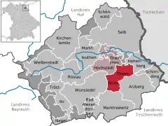 | |
 Thiersheim  Thiersheim | |
| Coordinates: 50°4′N 12°7′E / 50.067°N 12.117°E | |
| Country | Germany |
| State | Bavaria |
| Admin. region | Oberfranken |
| District | Wunsiedel im Fichtelgebirge |
| Municipal assoc. | Thiersheim |
| Subdivisions | 9 Ortschaften |
| Government | |
| • Mayor (2020–26) | Werner Frohmader[1] |
| Area | |
| • Total | 23.69 km2 (9.15 sq mi) |
| Elevation | 551 m (1,808 ft) |
| Population (2022-12-31)[2] | |
| • Total | 1,747 |
| • Density | 74/km2 (190/sq mi) |
| Time zone | UTC+01:00 (CET) |
| • Summer (DST) | UTC+02:00 (CEST) |
| Postal codes | 95707 |
| Dialling codes | 09233 |
| Vehicle registration | WUN |
| Website | www.thiersheim.de |
Thiersheim is a municipality in the district of Wunsiedel in Bavaria in Germany.
Grafenreuth, now a part of Thiersheim, was the seat of the noble family Gravenreuth for centuries.
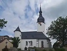 Evangelical Lutheran Church Sankt Ägidien (Saint Giles).
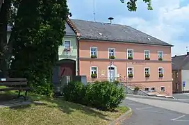
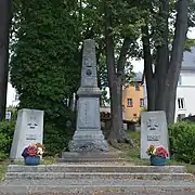 War memorial.
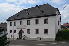 Gasthaus Weisses Ross.
References
- ↑ Liste der ersten Bürgermeister/Oberbürgermeister in kreisangehörigen Gemeinden, Bayerisches Landesamt für Statistik, 15 July 2021.
- ↑ Genesis Online-Datenbank des Bayerischen Landesamtes für Statistik Tabelle 12411-003r Fortschreibung des Bevölkerungsstandes: Gemeinden, Stichtag (Einwohnerzahlen auf Grundlage des Zensus 2011)
Towns and municipalities in Wunsiedel (district) | ||
|---|---|---|
This article is issued from Wikipedia. The text is licensed under Creative Commons - Attribution - Sharealike. Additional terms may apply for the media files.