Tlacolapilco | |
|---|---|
Town | |
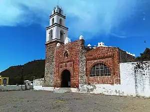 Church of San Lorenzo Mártir in Tlacotlapilco. | |
 Tlacolapilco  Tlacolapilco | |
| Coordinates: 20°22′37″N 99°13′13″W / 20.37694°N 99.22028°W | |
| Country | |
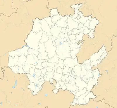
| State | Hidalgo |
| Municipality | Chilcuautla |
| Area | |
| • Total | 159.3 km2 (61.5 sq mi) |
| Population (2020) | |
| • Total | 810 |
| [1] | |
| Time zone | UTC-6:00 (Central) |
| Postal code | 42757 [2] |
| Area code | 738 [3] |
Tlacotlapilco is a town in the municipality of Chilcuautla, in the Mexican state of Hidalgo.
Demography
In 2020, it registered a population of 810 people, which corresponds to 4.28 % of the municipal population.[4] Of which 386 are men and 424 are women.[4] It has 1215 private inhabited homes.[4]
| Population of Tlacotlapilco |
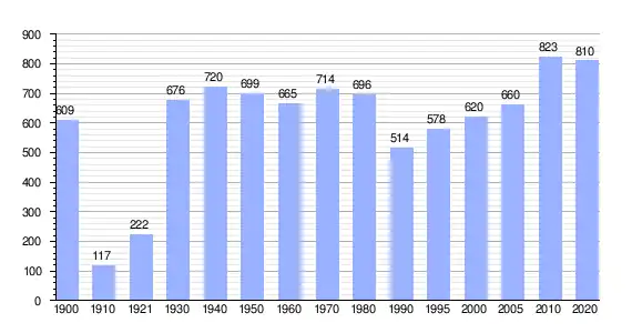 |
| Population of the censuses and counts of the National Institute of Statistics and Geography (INEGI).[4]
|
See also
References
- ↑ Instituto Nacional de Estadística y Geografía (2010). "Principales resultados por localidad 2010 (ITER)".
- ↑ Correos de México. "Consulta Códigos Postales". Secretariat of Infrastructure, Communications and Transportation (Mexico). Politics of Mexico. Retrieved January 17, 2021.
- ↑ Telmex. "Consulta de Claves LADA". Telephones in Mexico. Retrieved January 17, 2021.
- 1 2 3 4 Catálogo Localidades - Microrregiones. "Tlacotlapilco". Secretariat of Social Development. Government of Mexico.
This article is issued from Wikipedia. The text is licensed under Creative Commons - Attribution - Sharealike. Additional terms may apply for the media files.