Tomahawk | |
|---|---|
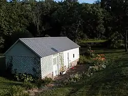 Tomahawk Springhouse | |
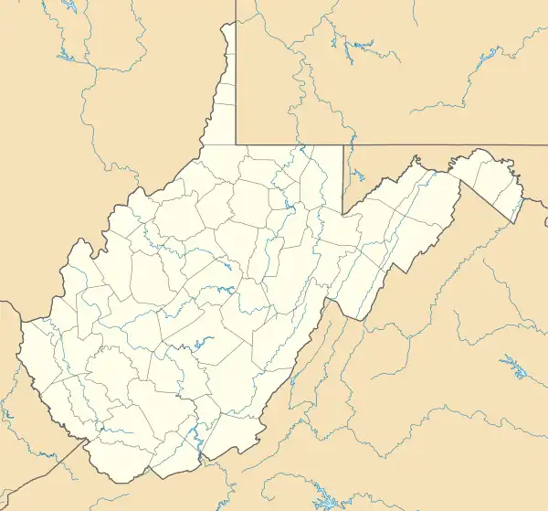 Tomahawk Location within the state of West Virginia  Tomahawk Tomahawk (the United States) | |
| Coordinates: 39°31′49″N 78°2′49″W / 39.53028°N 78.04694°W | |
| Country | United States |
| State | West Virginia |
| County | Berkeley |
| Elevation | 469 ft (143 m) |
| Time zone | UTC-5 (Eastern (EST)) |
| • Summer (DST) | UTC-4 (EDT) |
| GNIS feature ID | 1555816[1] |
Tomahawk is an unincorporated community on Back Creek in Berkeley County, West Virginia, United States.[1] The community is named for a nearby series of springs in the shape of a tomahawk.[2] The community includes the historic Tomahawk Presbyterian Church, established c. 1745, and its adjacent community cemetery, which has gravestones dating to the late 18th century. Tomahawk also has a popular dirt bike racetrack. The community lies 9.5 miles from Martinsburg.
Tomahawk Spring and the Park's Gap Bridge were listed on the National Register of Historic Places in 1994.[3]
References
- 1 2 "Tomahawk". Geographic Names Information System. United States Geological Survey, United States Department of the Interior.
- ↑ Kenny, Hamill (1945). West Virginia Place Names: Their Origin and Meaning, Including the Nomenclature of the Streams and Mountains. Piedmont, WV: The Place Name Press. p. 628.
- ↑ "National Register Information System". National Register of Historic Places. National Park Service. March 13, 2009.
External links
Municipalities and communities of Berkeley County, West Virginia, United States | ||
|---|---|---|
| City | 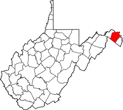 Map of West Virginia highlighting Berkeley County | |
| Town | ||
| CDPs | ||
| Unincorporated communities |
| |
| Ghost town | ||
This article is issued from Wikipedia. The text is licensed under Creative Commons - Attribution - Sharealike. Additional terms may apply for the media files.