Trostianets Raion
Тростянецький район | |
|---|---|
 Flag .png.webp) Coat of arms | |
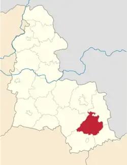 Raion location in Sumy Oblast | |
| Coordinates: 50°32′21.93″N 34°59′9.9306″E / 50.5394250°N 34.986091833°E | |
| Country | |
| Oblast | Sumy Oblast |
| Disestablished | 18 July 2020 |
| Admin. center | Trostianets |
| Area | |
| • Total | 1,065 km2 (411 sq mi) |
| Population (2020) | |
| • Total | 33,413 |
| • Density | 31/km2 (81/sq mi) |
| Time zone | UTC+2 (EET) |
| • Summer (DST) | UTC+3 (EEST) |
| Website | http://trostyanets-vlada.gov.ua/ |
Trostianets Raion (Ukrainian: Тростянецький район) was a raion in Sumy Oblast in Central Ukraine. The administrative center of the raion was the town of Trostianets.[1] The raion was abolished on 18 July 2020 as part of the administrative reform of Ukraine, which reduced the number of raions of Sumy Oblast to five.[2][3] The last estimate of the raion population was 33,413 (2020 est.).[4]
In March 1930 the Raion was the centre of a quickly defeated pro-Ukrainian anti-Soviet Union revolt.[5]
References
- ↑ http://static.rada.gov.ua/zakon/new/ADM/zmistsum.html
- ↑ "Про утворення та ліквідацію районів. Постанова Верховної Ради України № 807-ІХ". Голос України (in Ukrainian). 2020-07-18. Retrieved 2020-10-03.
- ↑ "Нові райони: карти + склад" (in Ukrainian). Міністерство розвитку громад та територій України. 17 July 2020.
- ↑ Чисельність наявного населення України на 1 січня 2020 року / Population of Ukraine Number of Existing as of January 1, 2020 (PDF) (in Ukrainian and English). Kyiv: State Statistics Service of Ukraine. Archived (PDF) from the original on 28 September 2023.
- ↑ A Different Peasantry, The Ukrainian Week (6 May 2011)
This article is issued from Wikipedia. The text is licensed under Creative Commons - Attribution - Sharealike. Additional terms may apply for the media files.