| Trostrey | |
|---|---|
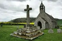 St David's Church | |
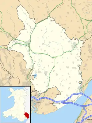 Trostrey Location within Monmouthshire | |
| OS grid reference | SO 360 044 |
| Principal area | |
| Preserved county | |
| Country | Wales |
| Sovereign state | United Kingdom |
| Post town | USK |
| Postcode district | NP15 |
| Dialling code | 01291 |
| Police | Gwent |
| Fire | South Wales |
| Ambulance | Welsh |
| UK Parliament | |
Trostrey (Welsh: Trostre) is a small hamlet and parish in Monmouthshire, in southeast Wales located about 2+1⁄2 miles (4.0 km) north/northwest of Usk.
History
Excavations at the castle in 2000 found evidence of burial cairns from the Neolithic and Bronze Age periods.[1] An 11th-century earthen motte-and-bailey castle was replaced in the 13th century by a small stone fort.[2] A manor house, Trostrey Court stands 1⁄2 mile (0.80 km) east of the village.[2] The Church of St David is dedicated to St David.[2]
Notes
- ↑ "TROSTREY CASTLE EXCAVATIONS - Coflein". www.coflein.gov.uk.
- 1 2 3 Newman 2000, pp. 582–3.
References
- Newman, John (2000). Gwent/Monmouthshire. The Buildings of Wales. Penguin. ISBN 0-14-071053-1.
This article is issued from Wikipedia. The text is licensed under Creative Commons - Attribution - Sharealike. Additional terms may apply for the media files.