| Tuscarora Mountains | |
|---|---|
_near_Tuscarora%252C_heading_towards_the_Tuscarora_Mountains_in_Nevada.jpg.webp) View of the Tuscarora Mountains from Midas-Tuscarora Road near Tuscarora, Nevada. | |
| Highest point | |
| Elevation | 2,340 m (7,680 ft) |
| Geography | |
| Country | United States |
| State | Nevada |
| District | Elko County |
| Range coordinates | 41°20′38″N 116°14′48″W / 41.34389°N 116.24667°W |
| Topo map | USGS Sugarloaf Butte |
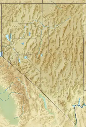
The Tuscarora Mountains are a mountain range in Elko and Eureka counties of northern, Nevada.[1] The southern perimeter of the north-south mountain range is the Humboldt River and valley. The community of Tuscarora lies on the east flank of the range.[2]
The range is named after the Tuscarora people.[3]
References
- 1 2 U.S. Geological Survey Geographic Names Information System: Tuscarora Mountains
- ↑ Nevada Atllas & Gazetteer, DeLorme, 8th ed. 2012, p. 23 ISBN 9780899333342
- ↑ Federal Writers' Project (1941). Origin of Place Names: Nevada (PDF). W.P.A. p. 30.
This article is issued from Wikipedia. The text is licensed under Creative Commons - Attribution - Sharealike. Additional terms may apply for the media files.