Ullastret | |
|---|---|
 | |
 Flag  Coat of arms | |
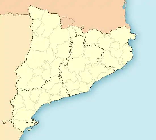 Ullastret Location in Catalonia  Ullastret Ullastret (Spain) | |
| Coordinates: 42°00′02″N 3°04′07″E / 42.000548°N 3.068483°E | |
| Country | |
| Community | |
| Province | Girona |
| Comarca | Baix Empordà |
| Government | |
| • Mayor | Josep Miquel Gatius Callís (2015)[1] |
| Area | |
| • Total | 11.1 km2 (4.3 sq mi) |
| Elevation | 49 m (161 ft) |
| Population (2018)[3] | |
| • Total | 286 |
| • Density | 26/km2 (67/sq mi) |
| Website | www |
Ullastret is a small historic village on the Bay of Empordà located some 5 km northeast of La Bisbal d'Empordà, in Catalonia.
In prehistoric times the village was probably on an island in the former 3 km2 lake, known as Llac d'Ullastret or Estany d'Ullastret, connected by a causway, but the lake dried up in the 19th century.[4]
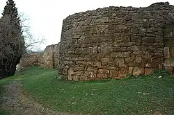
It is home to ancient Iberian archaeological remains, in particular much of the thick walls around the village are ancient. There is a medieval church known from the 9th century, dedicated to SS. Paul and Peter. The economy is based mostly on tourism and agriculture.
Gallery
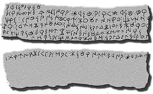 Inscribed lead plate from the Ullastret Iberian archaeological site
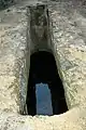 Cistern at the Ullastret site
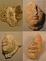 Terracota masks
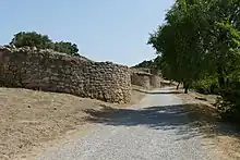 Walls
Walls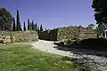 Walls
Walls.jpg.webp) Building remains
Building remains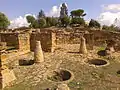 Building remains
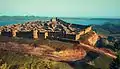 Digital reconstruction of Iberian Ullastret
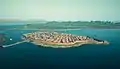 Digital reconstruction
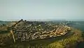 Digital reconstruction
See also
References
- ↑ "Ajuntament d'Ullastret". Generalitat of Catalonia. Retrieved 2015-11-13.
- ↑ "El municipi en xifres: Ullastret". Statistical Institute of Catalonia. Retrieved 2015-11-23.
- ↑ Municipal Register of Spain 2018. National Statistics Institute.
- ↑ Ullastret - Poblat Ibèric l'Illa d'en Reixac
External links
- Government data pages (in Catalan)
Places adjacent to Ullastret | |
|---|---|
This article is issued from Wikipedia. The text is licensed under Creative Commons - Attribution - Sharealike. Additional terms may apply for the media files.