Umburanas
Município de Umburanas | |
|---|---|
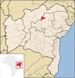 Location of Umburanas in Bahia | |
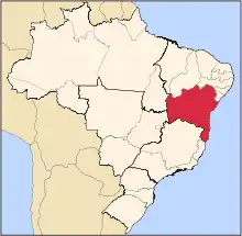
 Umburanas Location of Umburanas in the Brazil | |
| Coordinates: 10°43′58″S 41°19′33″W / 10.73278°S 41.32583°W | |
| Country | |
| Region | Northeast |
| State | |
| Government | |
| • Mayor | Raimundo Nonato da Silva (PSDB, 2009–2012) |
| Area | |
| • Total | 1,775.63 km2 (685.57 sq mi) |
| Population (2020) | |
| • Total | 19,402 |
| • Density | 11/km2 (28/sq mi) |
| Demonym | umburanense |
| Time zone | UTC−3 (BRT) |
| Website | www |
Umburanas is a municipality in the state of Bahia in the North-East region of Brazil. Umburanas covers 1,775.633 km2 (685.576 sq mi), and has a population of 19,402 with a population density of 10.2 inhabitants per square kilometer.[1] The municipality is located within the caatinga ecoregion.[2] Umburanas borders on five municipalities: Ourolândia, Mirangaba, Campo Formoso, Morro do Chapéu, and Sento Sé, all in the state of Bahia.
See also
References
- ↑ IBGE 2020
- ↑ "Umburanas". Brasília, Brazil: Instituto Brasileiro de Geografia e Estatstica. 2015. Retrieved 2015-07-24.
This article is issued from Wikipedia. The text is licensed under Creative Commons - Attribution - Sharealike. Additional terms may apply for the media files.