| Upper Sapey | |
|---|---|
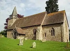 St Michael and All Angels, Upper Sapey | |
 Upper Sapey Location within Herefordshire | |
| Population | 460 (2011 Census) |
| Unitary authority | |
| Shire county | |
| Region | |
| Country | England |
| Sovereign state | United Kingdom |
| Post town | Worcester |
| Postcode district | WR6 |
| Police | West Mercia |
| Fire | Hereford and Worcester |
| Ambulance | West Midlands |
| UK Parliament | |
Upper Sapey is a small village and civil parish in Herefordshire, England.[1][2] It is located 4 miles (6 km) northeast of Bromyard. The population of this civil parish as taken at the 2011 census was 460.[3]
References
- ↑ Ordnance Survey: Landranger map sheet 138 Kidderminster & Wyre Forest (Map). Ordnance Survey. 2012. ISBN 9780319228340.
- ↑ "Ordnance Survey Election Maps". www.ordnancesurvey.co.uk. Ordnance Survey. Retrieved 3 April 2016.
- ↑ "Civil Parish population 2011". Retrieved 28 October 2015.
External links
![]() Media related to Upper Sapey at Wikimedia Commons
Media related to Upper Sapey at Wikimedia Commons
52°16′N 2°28′W / 52.267°N 2.467°W
This article is issued from Wikipedia. The text is licensed under Creative Commons - Attribution - Sharealike. Additional terms may apply for the media files.