Usquert | |
|---|---|
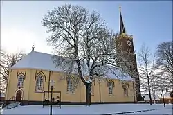 Usquert Church | |
 Coat of arms | |
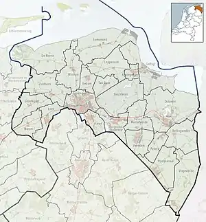 Usquert Location of Usquert in the province of Groningen | |
| Coordinates: 53°24′10″N 6°36′46″E / 53.40278°N 6.61278°E | |
| Country | Netherlands |
| Province | Groningen |
| Municipality | Het Hogeland |
| Area | |
| • Total | 1.37 km2 (0.53 sq mi) |
| Elevation | 0.7 m (2.3 ft) |
| Population (2021)[1] | |
| • Total | 1,180 |
| • Density | 860/km2 (2,200/sq mi) |
| Postal code | 9988[1] |
| Dialing code | 0595 |
Usquert is a village in the Dutch province of Groningen. It is located in the municipality of Het Hogeland. It had a population of around 1,415 in January 2017.[3]
History
Usquert was a separate municipality until 1990, when it became part of Hefshuizen.[4] After that, the name of the municipality was changed to Eemsmond in 1992.
 The church on the wierde
 Former Usquert town hall
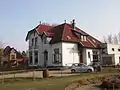 Villa in Usquert
 Farm in Usquert
References
- 1 2 3 "Kerncijfers wijken en buurten 2021". Central Bureau of Statistics. Retrieved 8 April 2022.
- ↑ "Postcodetool for 9988NP". Actueel Hoogtebestand Nederland (in Dutch). Het Waterschapshuis. Retrieved 8 April 2022.
- ↑ Kerncijfers wijken en buurten 2017 - CSB Statline
- ↑ Ad van der Meer and Onno Boonstra, Repertorium van Nederlandse gemeenten, KNAW, 2011.
External links
 Media related to Usquert at Wikimedia Commons
53°24′N 6°37′E / 53.400°N 6.617°E
This article is issued from Wikipedia. The text is licensed under Creative Commons - Attribution - Sharealike. Additional terms may apply for the media files.