Valeda, Kansas | |
|---|---|
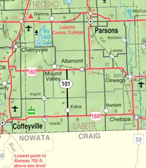 KDOT map of Labette County (legend) | |
 Valeda  Valeda | |
| Coordinates: 37°02′50″N 95°26′51″W / 37.04722°N 95.44750°W[1] | |
| Country | United States |
| State | Kansas |
| County | Labette |
| Founded | 1880s |
| Platted | 1886 |
| Elevation | 860 ft (260 m) |
| Time zone | UTC-6 (CST) |
| • Summer (DST) | UTC-5 (CDT) |
| Area code | 620 |
| FIPS code | 20-72700 [1] |
| GNIS ID | 469169 [1] |
Valeda is an unincorporated community in Labette County, Kansas, United States.[1]
History
References
- 1 2 3 4 5 "Valeda, Kansas", Geographic Names Information System, United States Geological Survey, United States Department of the Interior
- ↑ Blackmar, Frank Wilson (1912). Kansas: A Cyclopedia of State History, Volume 2. Standard Publishing Company. pp. 839.
Further reading
External links
Municipalities and communities of Labette County, Kansas, United States | ||
|---|---|---|
| Cities | 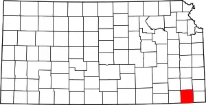 Map of Kansas highlighting Labette County | |
| Unincorporated communities | ||
| Ghost towns | ||
| Townships |
| |
| Footnotes | †This community is designated a Census-Designated Place (CDP) by the United States Census Bureau. | |
This article is issued from Wikipedia. The text is licensed under Creative Commons - Attribution - Sharealike. Additional terms may apply for the media files.