Vilkaviškis District Municipality
Vilkaviškio rajono savivaldybė | |
|---|---|
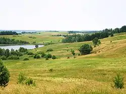 Sūduva Heights | |
 Coat of arms | |
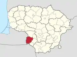 Location of Vilkaviškis district municipality within Lithuania | |
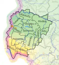 Map of Vilkaviškis district municipality | |
| Country | |
| Ethnographic region | Suvalkija |
| County | |
| Capital | Vilkaviškis |
| Elderships | 12 |
| Area | |
| • Total | 1,259 km2 (486 sq mi) |
| • Rank | 28th |
| Population (2021[1]) | |
| • Total | 35,368 |
| • Rank | 18-19th |
| • Density | 28/km2 (73/sq mi) |
| • Rank | 22nd |
| Time zone | UTC+2 (EET) |
| • Summer (DST) | UTC+3 (EEST) |
| Telephone code | 342 |
| Major settlements |
|
| Website | www |
Vilkaviškis District Municipality is one of 60 municipalities in Lithuania. Its administrative center is Vilkaviškis.
References
- ↑ "GYVENTOJAI GYVENAMOSIOSE VIETOVĖSE (INHABITANTS IN RESIDENTIAL AREAS)". Archived from the original on 2022-01-26. Retrieved 2023-12-25.
| Municipalities | 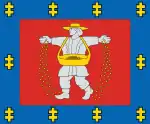 | |
|---|---|---|
| Cities | ||
| Towns | ||
| Villages | ||
54°34′30″N 22°59′17″E / 54.57500°N 22.98806°E
This article is issued from Wikipedia. The text is licensed under Creative Commons - Attribution - Sharealike. Additional terms may apply for the media files.