Villavard | |
|---|---|
Commune | |
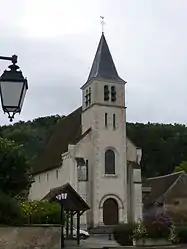 Church of Our Lady | |
.svg.png.webp) Coat of arms | |
Location of Villavard | |
 Villavard  Villavard | |
| Coordinates: 47°45′35″N 0°54′21″E / 47.7597°N 0.9058°E | |
| Country | France |
| Region | Centre-Val de Loire |
| Department | Loir-et-Cher |
| Arrondissement | Vendôme |
| Canton | Montoire-sur-le-Loir |
| Intercommunality | CA Territoires Vendômois |
| Government | |
| • Mayor (2020–2026) | Aimé Houdebert[1] |
| Area 1 | 5.18 km2 (2.00 sq mi) |
| Population | 127 |
| • Density | 25/km2 (63/sq mi) |
| Time zone | UTC+01:00 (CET) |
| • Summer (DST) | UTC+02:00 (CEST) |
| INSEE/Postal code | 41274 /41800 |
| Elevation | 65–131 m (213–430 ft) (avg. 70 m or 230 ft) |
| 1 French Land Register data, which excludes lakes, ponds, glaciers > 1 km2 (0.386 sq mi or 247 acres) and river estuaries. | |
Villavard (French pronunciation: [vilavaʁ]) is a commune in the Loir-et-Cher department in central France.
Population
| Year | Pop. | ±% p.a. |
|---|---|---|
| 1968 | 164 | — |
| 1975 | 156 | −0.71% |
| 1982 | 134 | −2.15% |
| 1990 | 127 | −0.67% |
| 1999 | 133 | +0.51% |
| 2007 | 147 | +1.26% |
| 2012 | 139 | −1.11% |
| 2017 | 128 | −1.64% |
| Source: INSEE[3] | ||
See also
References
- ↑ "Répertoire national des élus: les maires". data.gouv.fr, Plateforme ouverte des données publiques françaises (in French). 2 December 2020.
- ↑ "Populations légales 2021". The National Institute of Statistics and Economic Studies. 28 December 2023.
- ↑ Population en historique depuis 1968, INSEE
Wikimedia Commons has media related to Villavard.
This article is issued from Wikipedia. The text is licensed under Creative Commons - Attribution - Sharealike. Additional terms may apply for the media files.