| Volcán Tolimán | |
|---|---|
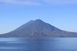 Volcán Tolimán from Panajachel (behind it is Volcán Atitlán) | |
| Highest point | |
| Elevation | 3,158 m (10,361 ft) |
| Prominence | 603 m (1,978 ft) |
| Coordinates | 14°36′48″N 91°11′22″W / 14.61333°N 91.18944°W |
| Geography | |
 Volcán Tolimán Guatemala | |
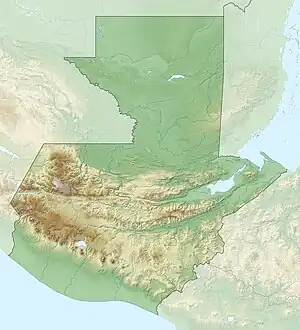
| Location | Sololá, Guatemala |
| Parent range | Sierra Madre |
| Geology | |
| Mountain type | Stratovolcano |
| Last eruption | Unknown |
Tolimán is a stratovolcano in Guatemala, on the southern shores of Lake Atitlán. Part of the Sierra Madre mountain range, the volcano has an elevation of 3,158 m (10,361 ft) and was formed near the southern margin of the Pleistocene Atitlán III caldera. The top of the volcano has a shallow crater and its flanks are covered with the thick remains of ancient lava flows that emerged from vents in the volcano's flanks.
Cerro de Oro
A parasitic lava dome, known as Cerro de Oro, was formed on the volcano's northern flank, which may have erupted a few thousand years ago.
Gallery
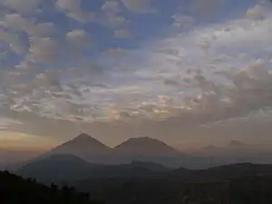 The volcanoes of Lake Atitlan; Atitlan (left center), Toliman (center), and San Pedro (far right), as seen from Pachimulin.
See also
References
- "Tolimán". Global Volcanism Program. Smithsonian Institution. Retrieved 2021-06-27.
| Guatemala |  | |
|---|---|---|
| El Salvador | ||
| Nicaragua | ||
| Costa Rica | ||
| Panama | ||
Note: volcanoes are ordered from north-west to south-east. | ||
This article is issued from Wikipedia. The text is licensed under Creative Commons - Attribution - Sharealike. Additional terms may apply for the media files.